Montjoie-le-Château
Montjoie-le-Château | |
|---|---|
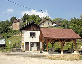 The town hall in Montjoie-le-Château | |
 Coat of arms | |
show Location of Montjoie-le-Château | |
 Montjoie-le-Château | |
| Coordinates: 47°21′02″N 6°54′09″E / 47.3506°N 6.9025°ECoordinates: 47°21′02″N 6°54′09″E / 47.3506°N 6.9025°E | |
| Country | France |
| Region | Bourgogne-Franche-Comté |
| Department | Doubs |
| Arrondissement | Montbéliard |
| Canton | Maîche |
| Government | |
| • Mayor (2020–2026) | Claude Martelet |
| Area 1 | 5.39 km2 (2.08 sq mi) |
| Population (Jan. 2018)[1] | 25 |
| • Density | 4.6/km2 (12/sq mi) |
| Time zone | UTC+01:00 (CET) |
| • Summer (DST) | UTC+02:00 (CEST) |
| INSEE/Postal code | 25402 /25190 |
| Elevation | 395–773 m (1,296–2,536 ft) |
| 1 French Land Register data, which excludes lakes, ponds, glaciers > 1 km2 (0.386 sq mi or 247 acres) and river estuaries. | |


Montjoie-le-Château (French pronunciation: [mɔ̃ʒwa l(ə) ʃɑto]; German previously: Frohberg) is a commune in the Doubs department in the Bourgogne-Franche-Comté region in eastern France.
Population[]
| Year | Pop. | ±% |
|---|---|---|
| 1962 | 27 | — |
| 1968 | 29 | +7.4% |
| 1975 | 23 | −20.7% |
| 1982 | 17 | −26.1% |
| 1990 | 21 | +23.5% |
| 1999 | 22 | +4.8% |
| 2008 | 26 | +18.2% |
| 2012 | 33 | +26.9% |
See also[]
References[]
- ^ "Populations légales 2018". INSEE. 28 December 2020.
External links[]
| Wikimedia Commons has media related to Montjoie-le-Château. |
| show Authority control |
|---|
This Doubs geographical article is a stub. You can help Wikipedia by . |
Categories:
- Communes of Doubs
- Doubs geography stubs