Les Gras
Les Gras | |
|---|---|
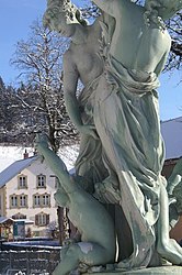 Fountain | |
show Location of Les Gras | |
 Les Gras | |
| Coordinates: 46°59′42″N 6°32′42″E / 46.995°N 6.545°ECoordinates: 46°59′42″N 6°32′42″E / 46.995°N 6.545°E | |
| Country | France |
| Region | Bourgogne-Franche-Comté |
| Department | Doubs |
| Arrondissement | Pontarlier |
| Canton | Morteau |
| Intercommunality | Val de Morteau |
| Government | |
| • Mayor (2008–2014) | Jean-Paul Bulliard |
| Area 1 | 14.99 km2 (5.79 sq mi) |
| Population (Jan. 2018)[1] | 783 |
| • Density | 52/km2 (140/sq mi) |
| Time zone | UTC+01:00 (CET) |
| • Summer (DST) | UTC+02:00 (CEST) |
| INSEE/Postal code | 25296 /25790 |
| Elevation | 782–1,290 m (2,566–4,232 ft) |
| 1 French Land Register data, which excludes lakes, ponds, glaciers > 1 km2 (0.386 sq mi or 247 acres) and river estuaries. | |


Les Gras is a commune in the Doubs department in the Bourgogne-Franche-Comté region in eastern France.
Population[]
| Year | Pop. | ±% |
|---|---|---|
| 1962 | 715 | — |
| 1968 | 727 | +1.7% |
| 1975 | 649 | −10.7% |
| 1982 | 585 | −9.9% |
| 1990 | 601 | +2.7% |
| 1999 | 654 | +8.8% |
| 2008 | 740 | +13.1% |
| 2012 | 784 | +5.9% |
See also[]
References[]
- ^ "Populations légales 2018". INSEE. 28 December 2020.
| Wikimedia Commons has media related to Les Gras. |
This Doubs geographical article is a stub. You can help Wikipedia by . |
Categories:
- Communes of Doubs
- Doubs geography stubs