Voires
Voires | |
|---|---|
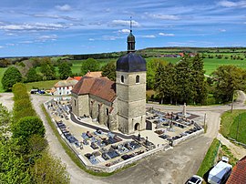 The church in La Barêche | |
show Location of Voires | |
 Voires | |
| Coordinates: 47°05′54″N 6°14′54″E / 47.0983°N 6.2483°ECoordinates: 47°05′54″N 6°14′54″E / 47.0983°N 6.2483°E | |
| Country | France |
| Region | Bourgogne-Franche-Comté |
| Department | Doubs |
| Arrondissement | Besançon |
| Canton | Valdahon |
| Intercommunality | |
| Government | |
| • Mayor (2014-2020) | Jean-Pierre Peugeot |
| Area 1 | 4.88 km2 (1.88 sq mi) |
| Population (Jan. 2018)[1] | 86 |
| • Density | 18/km2 (46/sq mi) |
| Time zone | UTC+01:00 (CET) |
| • Summer (DST) | UTC+02:00 (CEST) |
| INSEE/Postal code | 25630 /25580 |
| Elevation | 604–709 m (1,982–2,326 ft) |
| 1 French Land Register data, which excludes lakes, ponds, glaciers > 1 km2 (0.386 sq mi or 247 acres) and river estuaries. | |


Voires is a commune in the Doubs department' in the Bourgogne-Franche-Comté region in eastern France.
Population[]
| Year | Pop. | ±% |
|---|---|---|
| 1962 | 68 | — |
| 1968 | 72 | +5.9% |
| 1975 | 64 | −11.1% |
| 1982 | 49 | −23.4% |
| 1990 | 56 | +14.3% |
| 1999 | 57 | +1.8% |
| 2004 | 56 | −1.8% |
| 2008 | 57 | +1.8% |
| 2009 | 57 | +0.0% |
| 2014 | 91 | +59.6% |
| 2015 | 94 | +3.3% |
See also[]
References[]
- ^ "Populations légales 2018". INSEE. 28 December 2020.
| Wikimedia Commons has media related to Voires. |
This Doubs geographical article is a stub. You can help Wikipedia by . |
Categories:
- Communes of Doubs
- Doubs geography stubs