Longevilles-Mont-d'Or
Longevilles-Mont-d'Or | |
|---|---|
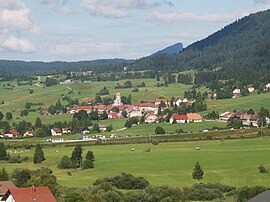 A general view of Longevilles-Mont-d'Or | |
show Location of Longevilles-Mont-d'Or | |
 Longevilles-Mont-d'Or | |
| Coordinates: 46°45′16″N 6°19′02″E / 46.7544°N 6.3172°ECoordinates: 46°45′16″N 6°19′02″E / 46.7544°N 6.3172°E | |
| Country | France |
| Region | Bourgogne-Franche-Comté |
| Department | Doubs |
| Arrondissement | Pontarlier |
| Canton | Frasne |
| Government | |
| • Mayor (2020–2026) | Claude Jacquemin-Verguet[1] |
| Area 1 | 13.25 km2 (5.12 sq mi) |
| Population (Jan. 2018)[2] | 597 |
| • Density | 45/km2 (120/sq mi) |
| Time zone | UTC+01:00 (CET) |
| • Summer (DST) | UTC+02:00 (CEST) |
| INSEE/Postal code | 25348 /25370 |
| Elevation | 890–1,463 m (2,920–4,800 ft) |
| 1 French Land Register data, which excludes lakes, ponds, glaciers > 1 km2 (0.386 sq mi or 247 acres) and river estuaries. | |


Longevilles-Mont-d'Or (French pronunciation: [lɔ̃ʒvil mɔ̃ dɔʁ]; unofficial also Les Longevilles) is a commune in the Doubs department in the Bourgogne-Franche-Comté region in eastern France.
Geography[]
The commune is located 10 km (6.2 mi) northeast of Mouthe. The village lies in a valley at the foot of the Mont d'Or, a massif that covers 90% of the territory of the commune.[citation needed]
The commune has views of the Alps and the Swiss plain.
Population[]
| Year | Pop. | ±% |
|---|---|---|
| 1962 | 215 | — |
| 1968 | 248 | +15.3% |
| 1975 | 253 | +2.0% |
| 1982 | 272 | +7.5% |
| 1990 | 323 | +18.8% |
| 1999 | 368 | +13.9% |
| 2008 | 405 | +10.1% |
| 2012 | 445 | +9.9% |
Economy[]
Winter sports and tourism dominate the economy of the commune. It is one of the six communes that have operated the ski resort since 1970.
See also[]
References[]
- ^ "Répertoire national des élus: les maires". data.gouv.fr, Plateforme ouverte des données publiques françaises (in French). 2 December 2020.
- ^ "Populations légales 2018". INSEE. 28 December 2020.
External links[]
| Wikimedia Commons has media related to Longevilles-Mont-d'Or. |
This Doubs geographical article is a stub. You can help Wikipedia by . |
Categories:
- Communes of Doubs
- Doubs geography stubs