Les Fins
Les Fins | |
|---|---|
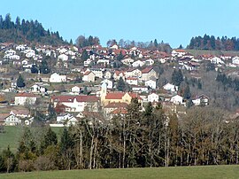 A general view of Les Fins | |
 Coat of arms | |
show Location of Les Fins | |
 Les Fins | |
| Coordinates: 47°04′54″N 6°37′45″E / 47.0817°N 6.6292°ECoordinates: 47°04′54″N 6°37′45″E / 47.0817°N 6.6292°E | |
| Country | France |
| Region | Bourgogne-Franche-Comté |
| Department | Doubs |
| Arrondissement | Pontarlier |
| Canton | Morteau |
| Intercommunality | Val de Morteau |
| Government | |
| • Mayor (2020–2026) | Elisabeth Redoutey |
| Area 1 | 25.39 km2 (9.80 sq mi) |
| Population (Jan. 2018)[1] | 3,171 |
| • Density | 120/km2 (320/sq mi) |
| Time zone | UTC+01:00 (CET) |
| • Summer (DST) | UTC+02:00 (CEST) |
| INSEE/Postal code | 25240 /25500 |
| Elevation | 750–1,154 m (2,461–3,786 ft) |
| 1 French Land Register data, which excludes lakes, ponds, glaciers > 1 km2 (0.386 sq mi or 247 acres) and river estuaries. | |


Les Fins (French pronunciation: [le fɛ̃]) is a commune in the Doubs department in the Bourgogne-Franche-Comté region in eastern France.
Population[]
| Year | Pop. | ±% |
|---|---|---|
| 1901 | 960 | — |
| 1906 | 1,022 | +6.5% |
| 1911 | 1,099 | +7.5% |
| 1921 | 1,071 | −2.5% |
| 1926 | 1,163 | +8.6% |
| 1931 | 1,207 | +3.8% |
| 1936 | 1,220 | +1.1% |
| 1946 | 1,185 | −2.9% |
| 1954 | 1,414 | +19.3% |
| 1962 | 1,641 | +16.1% |
| 1968 | 1,741 | +6.1% |
| 1975 | 2,201 | +26.4% |
| 1982 | 2,346 | +6.6% |
| 1990 | 2,441 | +4.0% |
| 1999 | 2,591 | +6.1% |
| 2008 | 2,816 | +8.7% |
| 2012 | 2,966 | +5.3% |
See also[]
References[]
- ^ "Populations légales 2018". INSEE. 28 December 2020.
| Wikimedia Commons has media related to Les Fins. |
This Doubs geographical article is a stub. You can help Wikipedia by . |
Categories:
- Communes of Doubs
- Doubs geography stubs