Aurimont
Aurimont | |
|---|---|
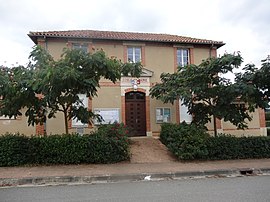 The town hall in Aurimont | |
show Location of Aurimont | |
 Aurimont | |
| Coordinates: 43°34′27″N 0°49′18″E / 43.5742°N 0.8217°ECoordinates: 43°34′27″N 0°49′18″E / 43.5742°N 0.8217°E | |
| Country | France |
| Region | Occitanie |
| Department | Gers |
| Arrondissement | Auch |
| Canton | Astarac-Gimone |
| Intercommunality | |
| Government | |
| • Mayor (2020–2026) | Jacques Faure |
| Area 1 | 8.07 km2 (3.12 sq mi) |
| Population (Jan. 2018)[1] | 209 |
| • Density | 26/km2 (67/sq mi) |
| Time zone | UTC+01:00 (CET) |
| • Summer (DST) | UTC+02:00 (CEST) |
| INSEE/Postal code | 32018 /32450 |
| Elevation | 157–235 m (515–771 ft) (avg. 180 m or 590 ft) |
| 1 French Land Register data, which excludes lakes, ponds, glaciers > 1 km2 (0.386 sq mi or 247 acres) and river estuaries. | |


Aurimont (French pronunciation: [oʁimɔ̃]) is a commune in the Gers department in southwestern France.
Geography[]

Aurimont and its surrounding communes
Population[]
| Year | Pop. | ±% |
|---|---|---|
| 1962 | 197 | — |
| 1968 | 143 | −27.4% |
| 1975 | 107 | −25.2% |
| 1982 | 123 | +15.0% |
| 1990 | 119 | −3.3% |
| 1999 | 134 | +12.6% |
| 2008 | 184 | +37.3% |
| 2015 | 201 | +9.2% |
See also[]
- Communes of the Gers department
References[]
- ^ "Populations légales 2018". INSEE. 28 December 2020.
| Wikimedia Commons has media related to Aurimont. |
| show Communes of the Gers department |
|---|
This Gers geographical article is a stub. You can help Wikipedia by . |
Categories:
- Communes of Gers
- Gers geography stubs