Lahitte
Lahitte | |
|---|---|
 Lahitte | |
show Location of Lahitte | |
 Lahitte | |
| Coordinates: 43°39′40″N 0°40′52″E / 43.6611°N 0.6811°ECoordinates: 43°39′40″N 0°40′52″E / 43.6611°N 0.6811°E | |
| Country | France |
| Region | Occitanie |
| Department | Gers |
| Arrondissement | Auch |
| Canton | Auch-2 |
| Intercommunality | Grand Auch |
| Government | |
| • Mayor (2020–2026) | Christian Dareoux |
| Area 1 | 5.03 km2 (1.94 sq mi) |
| Population (Jan. 2018)[1] | 236 |
| • Density | 47/km2 (120/sq mi) |
| Time zone | UTC+01:00 (CET) |
| • Summer (DST) | UTC+02:00 (CEST) |
| INSEE/Postal code | 32183 /32810 |
| Elevation | 148–240 m (486–787 ft) (avg. 170 m or 560 ft) |
| 1 French Land Register data, which excludes lakes, ponds, glaciers > 1 km2 (0.386 sq mi or 247 acres) and river estuaries. | |


Lahitte (French pronunciation: [la.it]; Occitan: La Hita) is a commune in the Gers department in southwestern France.
Geography[]

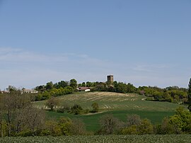
Lahitte and its surrounding communes
Population[]
| Year | Pop. | ±% |
|---|---|---|
| 1962 | 119 | — |
| 1968 | 134 | +12.6% |
| 1975 | 143 | +6.7% |
| 1982 | 148 | +3.5% |
| 1990 | 182 | +23.0% |
| 1999 | 185 | +1.6% |
| 2008 | 251 | +35.7% |
See also[]
- Communes of the Gers department
References[]
- ^ "Populations légales 2018". INSEE. 28 December 2020.
| Wikimedia Commons has media related to Lahitte (Gers). |
| show Communes of the Gers department |
|---|
This Gers geographical article is a stub. You can help Wikipedia by . |
Categories:
- Communes of Gers
- Gers geography stubs