Moncorneil-Grazan
Moncorneil-Grazan | |
|---|---|
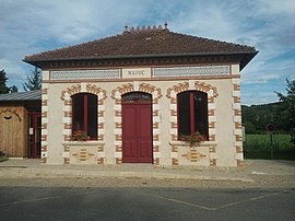 The town hall in Moncorneil-Grazan | |
show Location of Moncorneil-Grazan | |
 Moncorneil-Grazan | |
| Coordinates: 43°27′15″N 0°39′16″E / 43.4542°N 0.6544°ECoordinates: 43°27′15″N 0°39′16″E / 43.4542°N 0.6544°E | |
| Country | France |
| Region | Occitanie |
| Department | Gers |
| Arrondissement | Mirande |
| Canton | Astarac-Gimone |
| Intercommunality | Val de Gers |
| Government | |
| • Mayor (2008–2014) | Michel Bautillon |
| Area 1 | 7.09 km2 (2.74 sq mi) |
| Population (Jan. 2018)[1] | 147 |
| • Density | 21/km2 (54/sq mi) |
| Time zone | UTC+01:00 (CET) |
| • Summer (DST) | UTC+02:00 (CEST) |
| INSEE/Postal code | 32266 /32260 |
| Elevation | 204–314 m (669–1,030 ft) (avg. 212 m or 696 ft) |
| 1 French Land Register data, which excludes lakes, ponds, glaciers > 1 km2 (0.386 sq mi or 247 acres) and river estuaries. | |


Moncorneil-Grazan is a commune in the Gers department in southwestern France.
Geography[]

Moncorneil-Grazan and its surrounding communes
Population[]
| Year | Pop. | ±% |
|---|---|---|
| 1962 | 143 | — |
| 1968 | 129 | −9.8% |
| 1975 | 101 | −21.7% |
| 1982 | 109 | +7.9% |
| 1990 | 97 | −11.0% |
| 1999 | 104 | +7.2% |
| 2008 | 131 | +26.0% |
See also[]
- Communes of the Gers department
References[]
- ^ "Populations légales 2018". INSEE. 28 December 2020.
| Wikimedia Commons has media related to Moncorneil-Grazan. |
| show Communes of the Gers department |
|---|
This Gers geographical article is a stub. You can help Wikipedia by . |
Categories:
- Communes of Gers
- Gers geography stubs