Saint-Loube
Saint-Loube | |
|---|---|
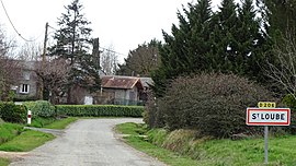 The road into Saint-Loube | |
show Location of Saint-Loube | |
 Saint-Loube | |
| Coordinates: 43°26′25″N 0°59′33″E / 43.4403°N 0.9925°ECoordinates: 43°26′25″N 0°59′33″E / 43.4403°N 0.9925°E | |
| Country | France |
| Region | Occitanie |
| Department | Gers |
| Arrondissement | Auch |
| Canton | Val de Save |
| Intercommunality | Savès |
| Government | |
| • Mayor (2008–2014) | Rémy Bagneris |
| Area 1 | 6.09 km2 (2.35 sq mi) |
| Population (Jan. 2018)[1] | 98 |
| • Density | 16/km2 (42/sq mi) |
| Time zone | UTC+01:00 (CET) |
| • Summer (DST) | UTC+02:00 (CEST) |
| INSEE/Postal code | 32387 /32220 |
| Elevation | 183–305 m (600–1,001 ft) (avg. 189 m or 620 ft) |
| 1 French Land Register data, which excludes lakes, ponds, glaciers > 1 km2 (0.386 sq mi or 247 acres) and river estuaries. | |


Saint-Loube is a commune in the Gers department in southwestern France.
Geography[]

Saint-Loube and its surrounding communes
Population[]
| Year | Pop. | ±% |
|---|---|---|
| 1962 | 120 | — |
| 1968 | 99 | −17.5% |
| 1975 | 83 | −16.2% |
| 1982 | 72 | −13.3% |
| 1990 | 69 | −4.2% |
| 1999 | 62 | −10.1% |
| 2008 | 90 | +45.2% |
See also[]
- Communes of the Gers department
References[]
- ^ "Populations légales 2018". INSEE. 28 December 2020.
| Wikimedia Commons has media related to Saint-Loube. |
| show Communes of the Gers department |
|---|
This Gers geographical article is a stub. You can help Wikipedia by . |
Categories:
- Communes of Gers
- Gers geography stubs