Mansencôme
Mansencôme | |
|---|---|
 Château du Busca in Mansencôme | |
show Location of Mansencôme | |
 Mansencôme | |
| Coordinates: 43°52′20″N 0°20′26″E / 43.8722°N 0.3406°ECoordinates: 43°52′20″N 0°20′26″E / 43.8722°N 0.3406°E | |
| Country | France |
| Region | Occitanie |
| Department | Gers |
| Arrondissement | Condom |
| Canton | Armagnac-Ténarèze |
| Intercommunality | Ténarèze |
| Government | |
| • Mayor (2020–2026) | Étienne Barrère |
| Area 1 | 4.05 km2 (1.56 sq mi) |
| Population (Jan. 2018)[1] | 47 |
| • Density | 12/km2 (30/sq mi) |
| Time zone | UTC+01:00 (CET) |
| • Summer (DST) | UTC+02:00 (CEST) |
| INSEE/Postal code | 32230 /32310 |
| Elevation | 112–201 m (367–659 ft) (avg. 200 m or 660 ft) |
| 1 French Land Register data, which excludes lakes, ponds, glaciers > 1 km2 (0.386 sq mi or 247 acres) and river estuaries. | |


Mansencôme (French pronunciation: [mɑ̃sɛ̃kom]; Gascon: Massencoma) is a commune in the Gers department in southwestern France.
Geography[]
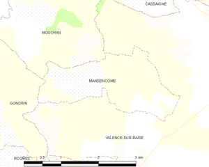
Mansencôme and its surrounding communes
Population[]
| Year | Pop. | ±% |
|---|---|---|
| 1962 | 110 | — |
| 1968 | 93 | −15.5% |
| 1975 | 88 | −5.4% |
| 1982 | 71 | −19.3% |
| 1990 | 69 | −2.8% |
| 1999 | 73 | +5.8% |
| 2008 | 67 | −8.2% |
See also[]
- Communes of the Gers department
References[]
- ^ "Populations légales 2018". INSEE. 28 December 2020.
| Wikimedia Commons has media related to Mansencôme. |
| show Communes of the Gers department |
|---|
This Gers geographical article is a stub. You can help Wikipedia by . |
Categories:
- Communes of Gers
- Gers geography stubs