Réans
Réans | |
|---|---|
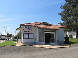 The town hall in Réans | |
show Location of Réans | |
 Réans | |
| Coordinates: 43°51′52″N 0°01′42″E / 43.8644°N 0.0283°ECoordinates: 43°51′52″N 0°01′42″E / 43.8644°N 0.0283°E | |
| Country | France |
| Region | Occitanie |
| Department | Gers |
| Arrondissement | Condom |
| Canton | Grand-Bas-Armagnac |
| Intercommunality | Grand-Armagnac |
| Government | |
| • Mayor (2008–2014) | Yvan Saint Martin |
| Area 1 | 12.31 km2 (4.75 sq mi) |
| Population (Jan. 2018)[1] | 290 |
| • Density | 24/km2 (61/sq mi) |
| Time zone | UTC+01:00 (CET) |
| • Summer (DST) | UTC+02:00 (CEST) |
| INSEE/Postal code | 32340 /32800 |
| Elevation | 108–186 m (354–610 ft) (avg. 136 m or 446 ft) |
| 1 French Land Register data, which excludes lakes, ponds, glaciers > 1 km2 (0.386 sq mi or 247 acres) and river estuaries. | |


Réans is a commune in the Gers department in southwestern France.
Geography[]

Réans and its surrounding communes
Population[]
| Year | Pop. | ±% |
|---|---|---|
| 1962 | 284 | — |
| 1968 | 281 | −1.1% |
| 1975 | 255 | −9.3% |
| 1982 | 282 | +10.6% |
| 1990 | 267 | −5.3% |
| 1999 | 257 | −3.7% |
| 2008 | 251 | −2.3% |
See also[]
- Communes of the Gers department
References[]
- ^ "Populations légales 2018". INSEE. 28 December 2020.
| Wikimedia Commons has media related to Réans. |
| show Communes of the Gers department |
|---|
This Gers geographical article is a stub. You can help Wikipedia by . |
Categories:
- Communes of Gers
- Gers geography stubs