Corneillan
Corneillan | |
|---|---|
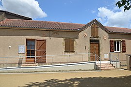 The town hall in Corneillan | |
 Coat of arms | |
show Location of Corneillan | |
 Corneillan | |
| Coordinates: 43°39′26″N 0°10′44″W / 43.6572°N 0.1789°WCoordinates: 43°39′26″N 0°10′44″W / 43.6572°N 0.1789°W | |
| Country | France |
| Region | Occitanie |
| Department | Gers |
| Arrondissement | Mirande |
| Canton | Adour-Gersoise |
| Intercommunality | Aire-sur-l'Adour |
| Government | |
| • Mayor (2020–2026) | Pascal Carreau |
| Area 1 | 8.47 km2 (3.27 sq mi) |
| Population (Jan. 2018)[1] | 153 |
| • Density | 18/km2 (47/sq mi) |
| Time zone | UTC+01:00 (CET) |
| • Summer (DST) | UTC+02:00 (CEST) |
| INSEE/Postal code | 32108 /32400 |
| Elevation | 85–160 m (279–525 ft) (avg. 152 m or 499 ft) |
| 1 French Land Register data, which excludes lakes, ponds, glaciers > 1 km2 (0.386 sq mi or 247 acres) and river estuaries. | |


Corneillan (French pronunciation: [kɔʁnɛjɑ̃]; Occitan: Cornelhan) is a commune in the Gers department in southwestern France.
Geography[]

Corneillan and its surrounding communes
Population[]
| Year | Pop. | ±% |
|---|---|---|
| 1962 | 153 | — |
| 1968 | 140 | −8.5% |
| 1975 | 121 | −13.6% |
| 1982 | 114 | −5.8% |
| 1990 | 115 | +0.9% |
| 1999 | 147 | +27.8% |
| 2008 | 139 | −5.4% |
See also[]
- Communes of the Gers department
References[]
- ^ "Populations légales 2018". INSEE. 28 December 2020.
| Wikimedia Commons has media related to Corneillan. |
| show Communes of the Gers department |
|---|
This Gers geographical article is a stub. You can help Wikipedia by . |
Categories:
- Communes of Gers
- Gers geography stubs