Monlezun
Monlezun | |
|---|---|
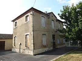 The town hall in Monlezun | |
show Location of Monlezun | |
 Monlezun | |
| Coordinates: 43°30′03″N 0°12′50″E / 43.5008°N 0.2139°ECoordinates: 43°30′03″N 0°12′50″E / 43.5008°N 0.2139°E | |
| Country | France |
| Region | Occitanie |
| Department | Gers |
| Arrondissement | Mirande |
| Canton | Pardiac-Rivière-Basse |
| Intercommunality | Bastides et vallons du Gers |
| Government | |
| • Mayor (2020–2026) | Michel Lille |
| Area 1 | 17.35 km2 (6.70 sq mi) |
| Population (Jan. 2018)[1] | 187 |
| • Density | 11/km2 (28/sq mi) |
| Time zone | UTC+01:00 (CET) |
| • Summer (DST) | UTC+02:00 (CEST) |
| INSEE/Postal code | 32273 /32230 |
| Elevation | 155–260 m (509–853 ft) (avg. 252 m or 827 ft) |
| 1 French Land Register data, which excludes lakes, ponds, glaciers > 1 km2 (0.386 sq mi or 247 acres) and river estuaries. | |


Monlezun (French pronunciation: [mɔ̃ləzœ̃]; Occitan: Montlesun) is a commune in the Gers department in southwestern France.
Geography[]

Monlezun and its surrounding communes
Population[]
| Year | Pop. | ±% |
|---|---|---|
| 1962 | 265 | — |
| 1968 | 218 | −17.7% |
| 1975 | 179 | −17.9% |
| 1982 | 195 | +8.9% |
| 1990 | 199 | +2.1% |
| 1999 | 189 | −5.0% |
| 2008 | 204 | +7.9% |
See also[]
- Communes of the Gers department
References[]
- ^ "Populations légales 2018". INSEE. 28 December 2020.
| Wikimedia Commons has media related to Monlezun. |
| show Communes of the Gers department |
|---|
This Gers geographical article is a stub. You can help Wikipedia by . |
Categories:
- Communes of Gers
- Gers geography stubs