Saint-Griède
Saint-Griède | |
|---|---|
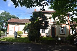 The town hall | |
show Location of Saint-Griède | |
 Saint-Griède | |
| Coordinates: 43°43′40″N 0°05′30″W / 43.7278°N 0.0917°WCoordinates: 43°43′40″N 0°05′30″W / 43.7278°N 0.0917°W | |
| Country | France |
| Region | Occitanie |
| Department | Gers |
| Arrondissement | Condom |
| Canton | Grand-Bas-Armagnac |
| Intercommunality | Bas-Armagnac |
| Government | |
| • Mayor (2020–2026) | Anne-Marie Saint-Pé[1] |
| Area 1 | 7.52 km2 (2.90 sq mi) |
| Population (Jan. 2018)[2] | 139 |
| • Density | 18/km2 (48/sq mi) |
| Time zone | UTC+01:00 (CET) |
| • Summer (DST) | UTC+02:00 (CEST) |
| INSEE/Postal code | 32380 /32110 |
| Elevation | 95–163 m (312–535 ft) (avg. 137 m or 449 ft) |
| 1 French Land Register data, which excludes lakes, ponds, glaciers > 1 km2 (0.386 sq mi or 247 acres) and river estuaries. | |


Saint-Griède is a commune in the Gers department in southwestern France.
Geography[]

Saint-Griède and its surrounding communes
Population[]
| Year | Pop. | ±% |
|---|---|---|
| 1962 | 140 | — |
| 1968 | 133 | −5.0% |
| 1975 | 114 | −14.3% |
| 1982 | 119 | +4.4% |
| 1990 | 118 | −0.8% |
| 1999 | 128 | +8.5% |
| 2008 | 133 | +3.9% |
See also[]
- Communes of the Gers department
References[]
- ^ "Répertoire national des élus: les maires". data.gouv.fr, Plateforme ouverte des données publiques françaises (in French). 2 December 2020.
- ^ "Populations légales 2018". INSEE. 28 December 2020.
| Wikimedia Commons has media related to Saint-Griède. |
| show Communes of the Gers department |
|---|
This Gers geographical article is a stub. You can help Wikipedia by . |
Categories:
- Communes of Gers
- Gers geography stubs