Terraube
Terraube | |
|---|---|
 The castle in Terraube | |
 Coat of arms | |
show Location of Terraube | |
 Terraube | |
| Coordinates: 43°54′27″N 0°33′09″E / 43.9075°N 0.5525°ECoordinates: 43°54′27″N 0°33′09″E / 43.9075°N 0.5525°E | |
| Country | France |
| Region | Occitanie |
| Department | Gers |
| Arrondissement | Condom |
| Canton | Lectoure-Lomagne |
| Government | |
| • Mayor (2020–2026) | Pierre Laffargue |
| Area 1 | 25.14 km2 (9.71 sq mi) |
| Population (Jan. 2018)[1] | 375 |
| • Density | 15/km2 (39/sq mi) |
| Time zone | UTC+01:00 (CET) |
| • Summer (DST) | UTC+02:00 (CEST) |
| INSEE/Postal code | 32442 /32700 |
| Elevation | 85–227 m (279–745 ft) (avg. 160 m or 520 ft) |
| 1 French Land Register data, which excludes lakes, ponds, glaciers > 1 km2 (0.386 sq mi or 247 acres) and river estuaries. | |


Terraube (French pronunciation: [tɛʁob]; Gascon: Terrauba) is a commune in the Gers department in southwestern France.
Geography[]
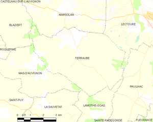
Terraube and its surrounding communes
Population[]
| Year | Pop. | ±% |
|---|---|---|
| 1962 | 520 | — |
| 1968 | 504 | −3.1% |
| 1975 | 522 | +3.6% |
| 1982 | 500 | −4.2% |
| 1990 | 435 | −13.0% |
| 1999 | 381 | −12.4% |
| 2008 | 391 | +2.6% |
See also[]
- Communes of the Gers department
References[]
- ^ "Populations légales 2018". INSEE. 28 December 2020.
| Wikimedia Commons has media related to Terraube. |
| show Communes of the Gers department |
|---|
| show Authority control |
|---|
This Gers geographical article is a stub. You can help Wikipedia by . |
Categories:
- Communes of Gers
- Gers geography stubs