Callian, Gers
Callian | |
|---|---|
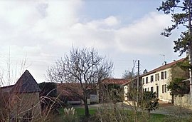 A view within Callian | |
show Location of Callian | |
 Callian | |
| Coordinates: 43°37′47″N 0°16′42″E / 43.6297°N 0.2783°ECoordinates: 43°37′47″N 0°16′42″E / 43.6297°N 0.2783°E | |
| Country | France |
| Region | Occitanie |
| Department | Gers |
| Arrondissement | Auch |
| Canton | Fezensac |
| Intercommunality | Artagnan en Fézensac |
| Government | |
| • Mayor (2020–2026) | Philippe Duces |
| Area 1 | 7.91 km2 (3.05 sq mi) |
| Population (Jan. 2018)[1] | 48 |
| • Density | 6.1/km2 (16/sq mi) |
| Time zone | UTC+01:00 (CET) |
| • Summer (DST) | UTC+02:00 (CEST) |
| INSEE/Postal code | 32072 /32190 |
| Elevation | 137–227 m (449–745 ft) (avg. 235 m or 771 ft) |
| 1 French Land Register data, which excludes lakes, ponds, glaciers > 1 km2 (0.386 sq mi or 247 acres) and river estuaries. | |


Callian (French pronunciation: [kaljɑ̃]; Occitan: Calhan) is a commune in the Gers department in southwestern France.
Geography[]

Callian and its surrounding communes
Population[]
| Year | Pop. | ±% |
|---|---|---|
| 1962 | 91 | — |
| 1968 | 78 | −14.3% |
| 1975 | 67 | −14.1% |
| 1982 | 60 | −10.4% |
| 1990 | 59 | −1.7% |
| 1999 | 50 | −15.3% |
| 2008 | 51 | +2.0% |
See also[]
- Communes of the Gers department
References[]
- ^ "Populations légales 2018". INSEE. 28 December 2020.
| Wikimedia Commons has media related to Callian (Gers). |
| show Communes of the Gers department |
|---|
This Gers geographical article is a stub. You can help Wikipedia by . |
Categories:
- Communes of Gers
- Gers geography stubs