Authon-du-Perche
Authon-du-Perche | |
|---|---|
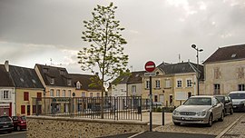 The Place du Marché in Authon-du-Perche | |
 Coat of arms | |
Location of Authon-du-Perche  | |
 Authon-du-Perche | |
| Coordinates: 48°11′47″N 0°53′36″E / 48.1964°N 0.8933°ECoordinates: 48°11′47″N 0°53′36″E / 48.1964°N 0.8933°E | |
| Country | France |
| Region | Centre-Val de Loire |
| Department | Eure-et-Loir |
| Arrondissement | Nogent-le-Rotrou |
| Canton | Brou |
| Intercommunality | |
| Government | |
| • Mayor (2020–2026) | Eric Girondeau[1] |
| Area 1 | 34.82 km2 (13.44 sq mi) |
| Population (Jan. 2018)[2] | 1,506 |
| • Density | 43/km2 (110/sq mi) |
| Time zone | UTC+01:00 (CET) |
| • Summer (DST) | UTC+02:00 (CEST) |
| INSEE/Postal code | 28018 /28330 |
| Elevation | 162–267 m (531–876 ft) |
| 1 French Land Register data, which excludes lakes, ponds, glaciers > 1 km2 (0.386 sq mi or 247 acres) and river estuaries. | |


Authon-du-Perche is a commune in the Eure-et-Loir department in northern France. On 1 January 2019, the former commune Soizé was merged into Authon-du-Perche.[3] The source of the river Braye is near the commune.[4]
Population[]
| Year | Pop. | ±% |
|---|---|---|
| 1836 | 1,650 | — |
| 1881 | 1,427 | −13.5% |
| 1901 | 1,439 | +0.8% |
| 1921 | 1,157 | −19.6% |
| 1946 | 1,186 | +2.5% |
| 1954 | 1,107 | −6.7% |
| 1962 | 1,166 | +5.3% |
| 1968 | 1,220 | +4.6% |
| 1975 | 1,396 | +14.4% |
| 1982 | 1,319 | −5.5% |
| 1990 | 1,270 | −3.7% |
| 1999 | 1,287 | +1.3% |
| 2008 | 1,285 | −0.2% |
| 2015 | 1,227 | −4.5% |
See also[]
- Communes of the Eure-et-Loir department
- Perche
References[]
- ^ "Répertoire national des élus: les maires". data.gouv.fr, Plateforme ouverte des données publiques françaises (in French). 9 August 2021.
- ^ "Populations légales 2018". The National Institute of Statistics and Economic Studies. 28 December 2020.
- ^ Arrêté préfectoral 9 July 2018 (in French)
- ^ Sandre. "Fiche cours d'eau - Braye (M12-0300)".
| Wikimedia Commons has media related to Authon-du-Perche. |
This Eure-et-Loir geographical article is a stub. You can help Wikipedia by . |
Categories:
- Communes of Eure-et-Loir
- Perche
- Eure-et-Loir geography stubs