Fontaine-les-Ribouts
Fontaine-les-Ribouts | |
|---|---|
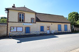 The town hall in Fontaine-les-Ribouts | |
show Location of Fontaine-les-Ribouts | |
 Fontaine-les-Ribouts | |
| Coordinates: 48°39′15″N 1°15′23″E / 48.6542°N 1.2564°ECoordinates: 48°39′15″N 1°15′23″E / 48.6542°N 1.2564°E | |
| Country | France |
| Region | Centre-Val de Loire |
| Department | Eure-et-Loir |
| Arrondissement | Dreux |
| Canton | Saint-Lubin-des-Joncherets |
| Intercommunality | CA Pays de Dreux |
| Government | |
| • Mayor (2008–2014) | Pascal Stinat |
| Area 1 | 7.12 km2 (2.75 sq mi) |
| Population (Jan. 2018)[1] | 205 |
| • Density | 29/km2 (75/sq mi) |
| Time zone | UTC+01:00 (CET) |
| • Summer (DST) | UTC+02:00 (CEST) |
| INSEE/Postal code | 28155 /28170 |
| Elevation | 120–174 m (394–571 ft) |
| 1 French Land Register data, which excludes lakes, ponds, glaciers > 1 km2 (0.386 sq mi or 247 acres) and river estuaries. | |


Fontaine-les-Ribouts is a commune in the Eure-et-Loir department in northern France.
Population[]
| Year | Pop. | ±% |
|---|---|---|
| 1962 | 76 | — |
| 1968 | 122 | +60.5% |
| 1975 | 150 | +23.0% |
| 1982 | 142 | −5.3% |
| 1990 | 201 | +41.5% |
| 1999 | 209 | +4.0% |
| 2008 | 241 | +15.3% |
See also[]
- Communes of the Eure-et-Loir department
References[]
- ^ "Populations légales 2018". INSEE. 28 December 2020.
| Wikimedia Commons has media related to Fontaine-les-Ribouts. |
| show Communes of the Eure-et-Loir department of France |
|---|
This Eure-et-Loir geographical article is a stub. You can help Wikipedia by . |
Categories:
- Communes of Eure-et-Loir
- Eure-et-Loir geography stubs