Marchéville
Marchéville | |
|---|---|
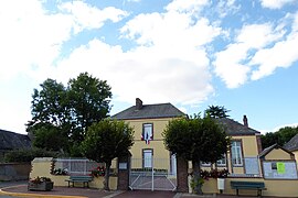 The town hall in Marchéville | |
show Location of Marchéville | |
 Marchéville | |
| Coordinates: 48°22′06″N 1°15′11″E / 48.3683°N 1.2531°ECoordinates: 48°22′06″N 1°15′11″E / 48.3683°N 1.2531°E | |
| Country | France |
| Region | Centre-Val de Loire |
| Department | Eure-et-Loir |
| Arrondissement | Chartres |
| Canton | Illiers-Combray |
| Government | |
| • Mayor (2020–2026) | Patrick Lage |
| Area 1 | 12.38 km2 (4.78 sq mi) |
| Population (Jan. 2018)[1] | 473 |
| • Density | 38/km2 (99/sq mi) |
| Time zone | UTC+01:00 (CET) |
| • Summer (DST) | UTC+02:00 (CEST) |
| INSEE/Postal code | 28234 /28120 |
| Elevation | 163–207 m (535–679 ft) (avg. 193 m or 633 ft) |
| 1 French Land Register data, which excludes lakes, ponds, glaciers > 1 km2 (0.386 sq mi or 247 acres) and river estuaries. | |


Marchéville (French pronunciation: [maʁʃevil]) is a commune in the Eure-et-Loir department in northern France.
Population[]
|
|
See also[]
- Communes of the Eure-et-Loir department
References[]
- ^ "Populations légales 2018". INSEE. 28 December 2020.
| Wikimedia Commons has media related to Marchéville. |
| show Communes of the Eure-et-Loir department of France |
|---|
This Eure-et-Loir geographical article is a stub. You can help Wikipedia by . |
Categories:
- Communes of Eure-et-Loir
- Eure-et-Loir geography stubs