Barjouville
Barjouville | |
|---|---|
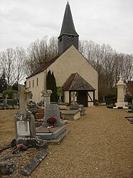 The church in Barjouville | |
 Coat of arms | |
show Location of Barjouville | |
 Barjouville | |
| Coordinates: 48°24′34″N 1°28′41″E / 48.4094°N 1.4781°ECoordinates: 48°24′34″N 1°28′41″E / 48.4094°N 1.4781°E | |
| Country | France |
| Region | Centre-Val de Loire |
| Department | Eure-et-Loir |
| Arrondissement | Chartres |
| Canton | Lucé |
| Intercommunality | CA Chartres Métropole |
| Government | |
| • Mayor (2008–2014) | Alain Toutay |
| Area 1 | 4.1 km2 (1.6 sq mi) |
| Population (Jan. 2018)[1] | 1,710 |
| • Density | 420/km2 (1,100/sq mi) |
| Time zone | UTC+01:00 (CET) |
| • Summer (DST) | UTC+02:00 (CEST) |
| INSEE/Postal code | 28024 /28630 |
| Elevation | 126–157 m (413–515 ft) (avg. 130 m or 430 ft) |
| 1 French Land Register data, which excludes lakes, ponds, glaciers > 1 km2 (0.386 sq mi or 247 acres) and river estuaries. | |


Barjouville is a commune in the Eure-et-Loir department in north-central France.
Population[]
| Year | Pop. | ±% |
|---|---|---|
| 1962 | 240 | — |
| 1968 | 354 | +47.5% |
| 1975 | 697 | +96.9% |
| 1982 | 975 | +39.9% |
| 1990 | 1,306 | +33.9% |
| 1999 | 1,392 | +6.6% |
| 2008 | 1,607 | +15.4% |
| 2009 | 1,599 | −0.5% |
See also[]
- Communes of the Eure-et-Loir department
References[]
- ^ "Populations légales 2018". INSEE. 28 December 2020.
| Wikimedia Commons has media related to Barjouville. |
| show Communes of the Eure-et-Loir department of France |
|---|
This Eure-et-Loir geographical article is a stub. You can help Wikipedia by . |
Categories:
- Communes of Eure-et-Loir
- Eure-et-Loir geography stubs