Pré-Saint-Évroult
Pré-Saint-Évroult | |
|---|---|
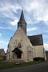 The church in Pré-Saint-Évroult | |
show Location of Pré-Saint-Évroult | |
 Pré-Saint-Évroult | |
| Coordinates: 48°11′07″N 1°28′07″E / 48.1853°N 1.4686°ECoordinates: 48°11′07″N 1°28′07″E / 48.1853°N 1.4686°E | |
| Country | France |
| Region | Centre-Val de Loire |
| Department | Eure-et-Loir |
| Arrondissement | Châteaudun |
| Canton | Les Villages Vovéens |
| Intercommunality | Bonnevalais |
| Government | |
| • Mayor (2020–2026) | Joël Lamy[1] |
| Area 1 | 21.51 km2 (8.31 sq mi) |
| Population (Jan. 2018)[2] | 296 |
| • Density | 14/km2 (36/sq mi) |
| Time zone | UTC+01:00 (CET) |
| • Summer (DST) | UTC+02:00 (CEST) |
| INSEE/Postal code | 28305 /28800 |
| Elevation | 127–141 m (417–463 ft) (avg. 134 m or 440 ft) |
| 1 French Land Register data, which excludes lakes, ponds, glaciers > 1 km2 (0.386 sq mi or 247 acres) and river estuaries. | |


Pré-Saint-Évroult is a commune in the Eure-et-Loir department in northern France.
Population[]
| Year | Pop. | ±% |
|---|---|---|
| 1962 | 296 | — |
| 1968 | 302 | +2.0% |
| 1975 | 294 | −2.6% |
| 1982 | 252 | −14.3% |
| 1990 | 291 | +15.5% |
| 1999 | 277 | −4.8% |
| 2008 | 315 | +13.7% |
See also[]
- Communes of the Eure-et-Loir department
References[]
- ^ "Répertoire national des élus: les maires". data.gouv.fr, Plateforme ouverte des données publiques françaises (in French). 2 December 2020. Retrieved 7 December 2020.
- ^ "Populations légales 2018". INSEE. 28 December 2020.
| Wikimedia Commons has media related to Pré-Saint-Évroult. |
| show Communes of the Eure-et-Loir department of France |
|---|
| show Authority control |
|---|
This Eure-et-Loir geographical article is a stub. You can help Wikipedia by . |
Categories:
- Communes of Eure-et-Loir
- Eure-et-Loir geography stubs