Thiville
Thiville | |
|---|---|
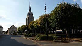 The church and surroundings in Thiville | |
show Location of Thiville | |
 Thiville | |
| Coordinates: 48°01′34″N 1°22′33″E / 48.0261°N 1.3758°ECoordinates: 48°01′34″N 1°22′33″E / 48.0261°N 1.3758°E | |
| Country | France |
| Region | Centre-Val de Loire |
| Department | Eure-et-Loir |
| Arrondissement | Châteaudun |
| Canton | Châteaudun |
| Government | |
| • Mayor (2020–2026) | Bruno Jorry[1] |
| Area 1 | 27.8 km2 (10.7 sq mi) |
| Population (Jan. 2018)[2] | 342 |
| • Density | 12/km2 (32/sq mi) |
| Time zone | UTC+01:00 (CET) |
| • Summer (DST) | UTC+02:00 (CEST) |
| INSEE/Postal code | 28389 /28200 |
| Elevation | 108–140 m (354–459 ft) (avg. 136 m or 446 ft) |
| 1 French Land Register data, which excludes lakes, ponds, glaciers > 1 km2 (0.386 sq mi or 247 acres) and river estuaries. | |


Thiville is a commune in the Eure-et-Loir department in northern France.
Population[]
| Year | Pop. | ±% |
|---|---|---|
| 1962 | 394 | — |
| 1968 | 429 | +8.9% |
| 1975 | 402 | −6.3% |
| 1982 | 367 | −8.7% |
| 1990 | 377 | +2.7% |
| 1999 | 354 | −6.1% |
| 2008 | 352 | −0.6% |
See also[]
- Communes of the Eure-et-Loir department
References[]
- ^ "Répertoire national des élus: les maires". data.gouv.fr, Plateforme ouverte des données publiques françaises (in French). 2 December 2020.
- ^ "Populations légales 2018". INSEE. 28 December 2020.
| Wikimedia Commons has media related to Thiville. |
| show Communes of the Eure-et-Loir department of France |
|---|
This Eure-et-Loir geographical article is a stub. You can help Wikipedia by . |
Categories:
- Communes of Eure-et-Loir
- Eure-et-Loir geography stubs