Cintray, Eure-et-Loir
Cintray | |
|---|---|
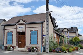 The town hall in Cintray | |
show Location of Cintray | |
 Cintray | |
| Coordinates: 48°26′57″N 1°21′59″E / 48.4492°N 1.3664°ECoordinates: 48°26′57″N 1°21′59″E / 48.4492°N 1.3664°E | |
| Country | France |
| Region | Centre-Val de Loire |
| Department | Eure-et-Loir |
| Arrondissement | Chartres |
| Canton | Lucé |
| Intercommunality | CA Chartres Métropole |
| Government | |
| • Mayor (2020–2026) | Frédéric Graupner |
| Area 1 | 4 km2 (2 sq mi) |
| Population (Jan. 2018)[1] | 425 |
| • Density | 110/km2 (280/sq mi) |
| Time zone | UTC+01:00 (CET) |
| • Summer (DST) | UTC+02:00 (CEST) |
| INSEE/Postal code | 28100 /28300 |
| Elevation | 148–166 m (486–545 ft) (avg. 157 m or 515 ft) |
| 1 French Land Register data, which excludes lakes, ponds, glaciers > 1 km2 (0.386 sq mi or 247 acres) and river estuaries. | |


Cintray (French pronunciation: [sɛ̃tʁɛ]) is a commune in the Eure-et-Loir department in northern France.
Population[]
| Year | Pop. | ±% |
|---|---|---|
| 1962 | 83 | — |
| 1968 | 101 | +21.7% |
| 1975 | 193 | +91.1% |
| 1982 | 230 | +19.2% |
| 1990 | 273 | +18.7% |
| 1999 | 388 | +42.1% |
| 2008 | 438 | +12.9% |
See also[]
- Communes of the Eure-et-Loir department
References[]
- ^ "Populations légales 2018". INSEE. 28 December 2020.
| Wikimedia Commons has media related to Cintray (Eure-et-Loir). |
| show Communes of the Eure-et-Loir department of France |
|---|
This Eure-et-Loir geographical article is a stub. You can help Wikipedia by . |
Categories:
- Communes of Eure-et-Loir
- Eure-et-Loir geography stubs