Baudreville, Eure-et-Loir
Baudreville | |
|---|---|
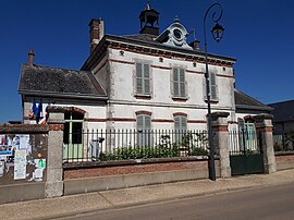 The town hall in Baudreville | |
show Location of Baudreville | |
 Baudreville | |
| Coordinates: 48°19′57″N 1°54′23″E / 48.3325°N 1.9064°ECoordinates: 48°19′57″N 1°54′23″E / 48.3325°N 1.9064°E | |
| Country | France |
| Region | Centre-Val de Loire |
| Department | Eure-et-Loir |
| Arrondissement | Chartres |
| Canton | Les Villages Vovéens |
| Intercommunality | Cœur de Beauce |
| Government | |
| • Mayor (2008–2014) | Damiens Decourty |
| Area 1 | 13.03 km2 (5.03 sq mi) |
| Population (Jan. 2018)[1] | 252 |
| • Density | 19/km2 (50/sq mi) |
| Time zone | UTC+01:00 (CET) |
| • Summer (DST) | UTC+02:00 (CEST) |
| INSEE/Postal code | 28026 /28310 |
| Elevation | 133–151 m (436–495 ft) (avg. 147 m or 482 ft) |
| 1 French Land Register data, which excludes lakes, ponds, glaciers > 1 km2 (0.386 sq mi or 247 acres) and river estuaries. | |


Baudreville is a commune in the Eure-et-Loir department in northern France.
Population[]
| Year | Pop. | ±% |
|---|---|---|
| 1962 | 261 | — |
| 1968 | 225 | −13.8% |
| 1975 | 257 | +14.2% |
| 1982 | 261 | +1.6% |
| 1990 | 247 | −5.4% |
| 1999 | 249 | +0.8% |
| 2008 | 283 | +13.7% |
See also[]
- Communes of the Eure-et-Loir department
References[]
- ^ "Populations légales 2018". INSEE. 28 December 2020.
| Wikimedia Commons has media related to Baudreville (Eure-et-Loir). |
| show Communes of the Eure-et-Loir department of France |
|---|
This Eure-et-Loir geographical article is a stub. You can help Wikipedia by . |
Categories:
- Communes of Eure-et-Loir
- Eure-et-Loir geography stubs