Conie-Molitard
Conie-Molitard | |
|---|---|
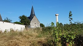 The church and surroundings in Conie-Molitard | |
show Location of Conie-Molitard | |
 Conie-Molitard | |
| Coordinates: 48°06′52″N 1°26′29″E / 48.1144°N 1.4414°ECoordinates: 48°06′52″N 1°26′29″E / 48.1144°N 1.4414°E | |
| Country | France |
| Region | Centre-Val de Loire |
| Department | Eure-et-Loir |
| Arrondissement | Châteaudun |
| Canton | Châteaudun |
| Government | |
| • Mayor (2008–2014) | Étienne Boissière |
| Area 1 | 15.17 km2 (5.86 sq mi) |
| Population (Jan. 2018)[1] | 407 |
| • Density | 27/km2 (69/sq mi) |
| Time zone | UTC+01:00 (CET) |
| • Summer (DST) | UTC+02:00 (CEST) |
| INSEE/Postal code | 28106 /28200 |
| Elevation | 110–149 m (361–489 ft) (avg. 1,301 m or 4,268 ft) |
| 1 French Land Register data, which excludes lakes, ponds, glaciers > 1 km2 (0.386 sq mi or 247 acres) and river estuaries. | |


Conie-Molitard is a commune in the Eure-et-Loir department in northern France.
Population[]
| Year | Pop. | ±% |
|---|---|---|
| 1962 | 205 | — |
| 1968 | 254 | +23.9% |
| 1975 | 233 | −8.3% |
| 1982 | 309 | +32.6% |
| 1990 | 337 | +9.1% |
| 1999 | 338 | +0.3% |
| 2008 | 376 | +11.2% |
See also[]
- Communes of the Eure-et-Loir department
References[]
- ^ "Populations légales 2018". INSEE. 28 December 2020.
| Wikimedia Commons has media related to Conie-Molitard. |
| show Communes of the Eure-et-Loir department of France |
|---|
This Eure-et-Loir geographical article is a stub. You can help Wikipedia by . |
Categories:
- Communes of Eure-et-Loir
- Eure-et-Loir geography stubs