La Chapelle-Forainvilliers
La Chapelle-Forainvilliers | |
|---|---|
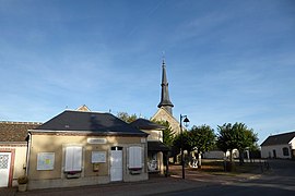 The town hall and church in La Chapelle-Forainvilliers | |
show Location of La Chapelle-Forainvilliers | |
 La Chapelle-Forainvilliers | |
| Coordinates: 48°43′46″N 1°30′09″E / 48.7294°N 1.5025°ECoordinates: 48°43′46″N 1°30′09″E / 48.7294°N 1.5025°E | |
| Country | France |
| Region | Centre-Val de Loire |
| Department | Eure-et-Loir |
| Arrondissement | Dreux |
| Canton | Anet |
| Intercommunality | CA Pays de Dreux |
| Government | |
| • Mayor (2008–2014) | Cécile Lamy-Moreau |
| Area 1 | 5.38 km2 (2.08 sq mi) |
| Population (Jan. 2018)[1] | 197 |
| • Density | 37/km2 (95/sq mi) |
| Time zone | UTC+01:00 (CET) |
| • Summer (DST) | UTC+02:00 (CEST) |
| INSEE/Postal code | 28076 /28500 |
| Elevation | 118–136 m (387–446 ft) (avg. 220 m or 720 ft) |
| 1 French Land Register data, which excludes lakes, ponds, glaciers > 1 km2 (0.386 sq mi or 247 acres) and river estuaries. | |


La Chapelle-Forainvilliers is a commune in the Eure-et-Loir department in northern France.
Population[]
| Year | Pop. | ±% |
|---|---|---|
| 1962 | 49 | — |
| 1968 | 70 | +42.9% |
| 1975 | 95 | +35.7% |
| 1982 | 77 | −18.9% |
| 1990 | 120 | +55.8% |
| 1999 | 169 | +40.8% |
| 2008 | 174 | +3.0% |
See also[]
- Communes of the Eure-et-Loir department
References[]
- ^ "Populations légales 2018". INSEE. 28 December 2020.
| Wikimedia Commons has media related to La Chapelle-Forainvilliers. |
| show Communes of the Eure-et-Loir department of France |
|---|
This Eure-et-Loir geographical article is a stub. You can help Wikipedia by . |
Categories:
- Communes of Eure-et-Loir
- Eure-et-Loir geography stubs