Châtaincourt
Châtaincourt | |
|---|---|
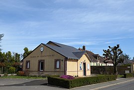 The town hall in Châtaincourt | |
show Location of Châtaincourt | |
 Châtaincourt | |
| Coordinates: 48°41′43″N 1°13′42″E / 48.6953°N 1.2283°ECoordinates: 48°41′43″N 1°13′42″E / 48.6953°N 1.2283°E | |
| Country | France |
| Region | Centre-Val de Loire |
| Department | Eure-et-Loir |
| Arrondissement | Dreux |
| Canton | Saint-Lubin-des-Joncherets |
| Intercommunality | CA Pays de Dreux |
| Government | |
| • Mayor (2008–2014) | Jean-Paul Sorand |
| Area 1 | 14.82 km2 (5.72 sq mi) |
| Population (Jan. 2018)[1] | 238 |
| • Density | 16/km2 (42/sq mi) |
| Time zone | UTC+01:00 (CET) |
| • Summer (DST) | UTC+02:00 (CEST) |
| INSEE/Postal code | 28087 /28270 |
| Elevation | 139–176 m (456–577 ft) (avg. 160 m or 520 ft) |
| 1 French Land Register data, which excludes lakes, ponds, glaciers > 1 km2 (0.386 sq mi or 247 acres) and river estuaries. | |


Châtaincourt is a commune in the Eure-et-Loir department in northern France.
Population[]
| Year | Pop. | ±% |
|---|---|---|
| 1962 | 139 | — |
| 1968 | 169 | +21.6% |
| 1975 | 143 | −15.4% |
| 1982 | 190 | +32.9% |
| 1990 | 237 | +24.7% |
| 1999 | 262 | +10.5% |
| 2008 | 240 | −8.4% |
See also[]
- Communes of the Eure-et-Loir department
References[]
- ^ "Populations légales 2018". INSEE. 28 December 2020.
| Wikimedia Commons has media related to Châtaincourt. |
| show Communes of the Eure-et-Loir department of France |
|---|
This Eure-et-Loir geographical article is a stub. You can help Wikipedia by . |
Categories:
- Communes of Eure-et-Loir
- Eure-et-Loir geography stubs