Les Autels-Villevillon
Les Autels-Villevillon | |
|---|---|
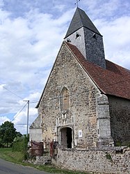 The church in Villevillon | |
show Location of Les Autels-Villevillon | |
 Les Autels-Villevillon | |
| Coordinates: 48°10′27″N 0°59′56″E / 48.1742°N 0.9989°ECoordinates: 48°10′27″N 0°59′56″E / 48.1742°N 0.9989°E | |
| Country | France |
| Region | Centre-Val de Loire |
| Department | Eure-et-Loir |
| Arrondissement | Nogent-le-Rotrou |
| Canton | Brou |
| Government | |
| • Mayor (2020–2026) | Luc Callu[1] |
| Area 1 | 10.08 km2 (3.89 sq mi) |
| Population (Jan. 2018)[2] | 143 |
| • Density | 14/km2 (37/sq mi) |
| Time zone | UTC+01:00 (CET) |
| • Summer (DST) | UTC+02:00 (CEST) |
| INSEE/Postal code | 28016 /28330 |
| Elevation | 174–217 m (571–712 ft) |
| 1 French Land Register data, which excludes lakes, ponds, glaciers > 1 km2 (0.386 sq mi or 247 acres) and river estuaries. | |


Les Autels-Villevillon (French pronunciation: [le.z‿otɛl vilvijɔ̃]) is a commune in the Eure-et-Loir department in northern France.
Population[]
| Year | Pop. | ±% |
|---|---|---|
| 1962 | 279 | — |
| 1968 | 281 | +0.7% |
| 1975 | 200 | −28.8% |
| 1982 | 140 | −30.0% |
| 1990 | 135 | −3.6% |
| 1999 | 120 | −11.1% |
| 2008 | 141 | +17.5% |
See also[]
- Communes of the Eure-et-Loir department
References[]
- ^ "Répertoire national des élus: les maires". data.gouv.fr, Plateforme ouverte des données publiques françaises (in French). 2 December 2020.
- ^ "Populations légales 2018". INSEE. 28 December 2020.
| Wikimedia Commons has media related to Les Autels-Villevillon. |
| show Communes of the Eure-et-Loir department of France |
|---|
This Eure-et-Loir geographical article is a stub. You can help Wikipedia by . |
Categories:
- Communes of Eure-et-Loir
- Eure-et-Loir geography stubs