La Chaussée-d'Ivry
La Chaussée-d'Ivry | |
|---|---|
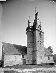 The church in La Chaussée-d'Ivry | |
 Coat of arms | |
show Location of La Chaussée-d'Ivry | |
 La Chaussée-d'Ivry | |
| Coordinates: 48°52′59″N 1°28′48″E / 48.8831°N 1.48°ECoordinates: 48°52′59″N 1°28′48″E / 48.8831°N 1.48°E | |
| Country | France |
| Region | Centre-Val de Loire |
| Department | Eure-et-Loir |
| Arrondissement | Dreux |
| Canton | Anet |
| Intercommunality | CA Pays de Dreux |
| Government | |
| • Mayor (2020–2026) | Francis Pecquenard |
| Area 1 | 8.39 km2 (3.24 sq mi) |
| Population (Jan. 2018)[1] | 1,189 |
| • Density | 140/km2 (370/sq mi) |
| Time zone | UTC+01:00 (CET) |
| • Summer (DST) | UTC+02:00 (CEST) |
| INSEE/Postal code | 28096 /28260 |
| Elevation | 52–168 m (171–551 ft) |
| 1 French Land Register data, which excludes lakes, ponds, glaciers > 1 km2 (0.386 sq mi or 247 acres) and river estuaries. | |


La Chaussée-d'Ivry (French pronunciation: [la ʃose divʁi], literally The Causeway of Ivry) is a commune in the Eure-et-Loir department in northern France.
Population[]
| Year | Pop. | ±% |
|---|---|---|
| 1962 | 470 | — |
| 1968 | 541 | +15.1% |
| 1975 | 649 | +20.0% |
| 1982 | 879 | +35.4% |
| 1990 | 965 | +9.8% |
| 1999 | 924 | −4.2% |
| 2008 | 1,011 | +9.4% |
See also[]
- Communes of the Eure-et-Loir department
References[]
- ^ "Populations légales 2018". INSEE. 28 December 2020.
| Wikimedia Commons has media related to La Chaussée-d'Ivry. |
| show Communes of the Eure-et-Loir department of France |
|---|
This Eure-et-Loir geographical article is a stub. You can help Wikipedia by . |
Categories:
- Communes of Eure-et-Loir
- Eure-et-Loir geography stubs