Chapelle-Guillaume
Chapelle-Guillaume | |
|---|---|
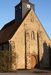 The church in Chapelle-Guillaume | |
show Location of Chapelle-Guillaume | |
 Chapelle-Guillaume | |
| Coordinates: 48°06′50″N 0°54′21″E / 48.1139°N 0.9058°ECoordinates: 48°06′50″N 0°54′21″E / 48.1139°N 0.9058°E | |
| Country | France |
| Region | Centre-Val de Loire |
| Department | Eure-et-Loir |
| Arrondissement | Nogent-le-Rotrou |
| Canton | Brou |
| Government | |
| • Mayor (2020–2026) | Joël Ferré[1] |
| Area 1 | 19.86 km2 (7.67 sq mi) |
| Population (Jan. 2018)[2] | 185 |
| • Density | 9.3/km2 (24/sq mi) |
| Time zone | UTC+01:00 (CET) |
| • Summer (DST) | UTC+02:00 (CEST) |
| INSEE/Postal code | 28078 /28330 |
| Elevation | 184–251 m (604–823 ft) (avg. 207 m or 679 ft) |
| 1 French Land Register data, which excludes lakes, ponds, glaciers > 1 km2 (0.386 sq mi or 247 acres) and river estuaries. | |


Chapelle-Guillaume is a commune in the Eure-et-Loir department in northern France.
Population[]
| Year | Pop. | ±% |
|---|---|---|
| 1962 | 280 | — |
| 1968 | 322 | +15.0% |
| 1975 | 260 | −19.3% |
| 1982 | 236 | −9.2% |
| 1990 | 190 | −19.5% |
| 1999 | 188 | −1.1% |
| 2008 | 200 | +6.4% |
See also[]
- Communes of the Eure-et-Loir department
References[]
- ^ "Répertoire national des élus: les maires". data.gouv.fr, Plateforme ouverte des données publiques françaises (in French). 2 December 2020.
- ^ "Populations légales 2018". INSEE. 28 December 2020.
| Wikimedia Commons has media related to Chapelle-Guillaume. |
| show Communes of the Eure-et-Loir department of France |
|---|
This Eure-et-Loir geographical article is a stub. You can help Wikipedia by . |
Categories:
- Communes of Eure-et-Loir
- Eure-et-Loir geography stubs