Gellainville
This article relies largely or entirely on a single source. (January 2016) |
Gellainville | |
|---|---|
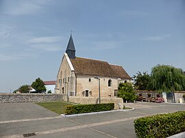 The church in Gellainville | |
show Location of Gellainville | |
 Gellainville | |
| Coordinates: 48°24′32″N 1°31′48″E / 48.4089°N 1.53°ECoordinates: 48°24′32″N 1°31′48″E / 48.4089°N 1.53°E | |
| Country | France |
| Region | Centre-Val de Loire |
| Department | Eure-et-Loir |
| Arrondissement | Chartres |
| Canton | Chartres-2 |
| Intercommunality | CA Chartres Métropole |
| Government | |
| • Mayor (2008–2014) | Michel Préveaux |
| Area 1 | 12.01 km2 (4.64 sq mi) |
| Population (Jan. 2018)[1] | 662 |
| • Density | 55/km2 (140/sq mi) |
| Time zone | UTC+01:00 (CET) |
| • Summer (DST) | UTC+02:00 (CEST) |
| INSEE/Postal code | 28177 /28630 |
| Elevation | 137–156 m (449–512 ft) (avg. 148 m or 486 ft) |
| 1 French Land Register data, which excludes lakes, ponds, glaciers > 1 km2 (0.386 sq mi or 247 acres) and river estuaries. | |


Gellainville is a commune in the Eure-et-Loir department in northern France.
Population[]
| Year | Pop. | ±% |
|---|---|---|
| 1962 | 263 | — |
| 1968 | 273 | +3.8% |
| 1975 | 291 | +6.6% |
| 1982 | 364 | +25.1% |
| 1990 | 413 | +13.5% |
| 1999 | 409 | −1.0% |
| 2008 | 489 | +19.6% |
See also[]
- Communes of the Eure-et-Loir department
References[]
- ^ "Populations légales 2018". INSEE. 28 December 2020.
| Wikimedia Commons has media related to Gellainville. |
| show Communes of the Eure-et-Loir department of France |
|---|
This Eure-et-Loir geographical article is a stub. You can help Wikipedia by . |
Categories:
- Communes of Eure-et-Loir
- Eure-et-Loir geography stubs