Marchezais
Marchezais | |
|---|---|
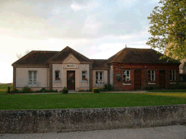 Town hall | |
 Coat of arms | |
show Location of Marchezais | |
 Marchezais | |
| Coordinates: 48°46′23″N 1°30′32″E / 48.7731°N 1.5089°ECoordinates: 48°46′23″N 1°30′32″E / 48.7731°N 1.5089°E | |
| Country | France |
| Region | Centre-Val de Loire |
| Department | Eure-et-Loir |
| Arrondissement | Dreux |
| Canton | Anet |
| Intercommunality | CA Pays de Dreux |
| Government | |
| • Mayor (2020–2026) | Jérôme Depondt |
| Area 1 | 2.19 km2 (0.85 sq mi) |
| Population (Jan. 2018)[1] | 357 |
| • Density | 160/km2 (420/sq mi) |
| Time zone | UTC+01:00 (CET) |
| • Summer (DST) | UTC+02:00 (CEST) |
| INSEE/Postal code | 28235 /28410 |
| Elevation | 132–139 m (433–456 ft) (avg. 138 m or 453 ft) |
| 1 French Land Register data, which excludes lakes, ponds, glaciers > 1 km2 (0.386 sq mi or 247 acres) and river estuaries. | |


Marchezais (French pronunciation: [maʁʃəzɛ]) is a commune in the Eure-et-Loir department in northern France.
Population[]
| Year | Pop. | ±% |
|---|---|---|
| 1962 | 43 | — |
| 1968 | 47 | +9.3% |
| 1975 | 99 | +110.6% |
| 1982 | 169 | +70.7% |
| 1990 | 221 | +30.8% |
| 1999 | 208 | −5.9% |
| 2008 | 289 | +38.9% |
See also[]
- Communes of the Eure-et-Loir department
References[]
- ^ "Populations légales 2018". INSEE. 28 December 2020.
| Wikimedia Commons has media related to Marchezais. |
| show Communes of the Eure-et-Loir department of France |
|---|
This Eure-et-Loir geographical article is a stub. You can help Wikipedia by . |
Categories:
- Communes of Eure-et-Loir
- Eure-et-Loir geography stubs