Belhomert-Guéhouville
Belhomert-Guéhouville | |
|---|---|
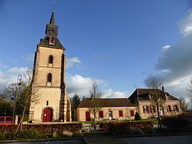 The church and library in Belhomert-Guéhouville | |
 Coat of arms | |
show Location of Belhomert-Guéhouville | |
 Belhomert-Guéhouville | |
| Coordinates: 48°30′24″N 1°03′30″E / 48.5067°N 1.0583°ECoordinates: 48°30′24″N 1°03′30″E / 48.5067°N 1.0583°E | |
| Country | France |
| Region | Centre-Val de Loire |
| Department | Eure-et-Loir |
| Arrondissement | Nogent-le-Rotrou |
| Canton | Nogent-le-Rotrou |
| Government | |
| • Mayor (2008–2014) | François Perrot |
| Area 1 | 10.95 km2 (4.23 sq mi) |
| Population (Jan. 2018)[1] | 799 |
| • Density | 73/km2 (190/sq mi) |
| Time zone | UTC+01:00 (CET) |
| • Summer (DST) | UTC+02:00 (CEST) |
| INSEE/Postal code | 28033 /28240 |
| Elevation | 182–271 m (597–889 ft) (avg. 199 m or 653 ft) |
| Website | http://belhomert-guehouville.fr |
| 1 French Land Register data, which excludes lakes, ponds, glaciers > 1 km2 (0.386 sq mi or 247 acres) and river estuaries. | |


Belhomert-Guéhouville is a commune in the Eure-et-Loir department in northern France.
Population[]
| Year | Pop. | ±% |
|---|---|---|
| 1962 | 431 | — |
| 1968 | 437 | +1.4% |
| 1975 | 472 | +8.0% |
| 1982 | 589 | +24.8% |
| 1990 | 773 | +31.2% |
| 1999 | 808 | +4.5% |
| 2008 | 822 | +1.7% |
See also[]
- Communes of the Eure-et-Loir department
References[]
- ^ "Populations légales 2018". INSEE. 28 December 2020.
| Wikimedia Commons has media related to Belhomert-Guéhouville. |
| show Communes of the Eure-et-Loir department of France |
|---|
This Eure-et-Loir geographical article is a stub. You can help Wikipedia by . |
Categories:
- Communes of Eure-et-Loir
- Eure-et-Loir geography stubs