Le Favril, Eure-et-Loir
Le Favril | |
|---|---|
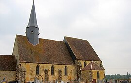 The church in Le Favril | |
show Location of Le Favril | |
 Le Favril | |
| Coordinates: 48°27′52″N 1°07′46″E / 48.4644°N 1.1294°ECoordinates: 48°27′52″N 1°07′46″E / 48.4644°N 1.1294°E | |
| Country | France |
| Region | Centre-Val de Loire |
| Department | Eure-et-Loir |
| Arrondissement | Chartres |
| Canton | Illiers-Combray |
| Government | |
| • Mayor (2020–2026) | John Billard[1] |
| Area 1 | 23.8 km2 (9.2 sq mi) |
| Population (Jan. 2018)[2] | 369 |
| • Density | 16/km2 (40/sq mi) |
| Time zone | UTC+01:00 (CET) |
| • Summer (DST) | UTC+02:00 (CEST) |
| INSEE/Postal code | 28148 /28190 |
| Elevation | 178–247 m (584–810 ft) |
| 1 French Land Register data, which excludes lakes, ponds, glaciers > 1 km2 (0.386 sq mi or 247 acres) and river estuaries. | |


Le Favril (French pronunciation: [lə favʁil]) is a commune in the Eure-et-Loir department in northern France.
Population[]
| Year | Pop. | ±% |
|---|---|---|
| 1962 | 225 | — |
| 1968 | 277 | +23.1% |
| 1975 | 268 | −3.2% |
| 1982 | 266 | −0.7% |
| 1990 | 300 | +12.8% |
| 1999 | 280 | −6.7% |
| 2008 | 324 | +15.7% |
See also[]
- Communes of the Eure-et-Loir department
References[]
- ^ "Répertoire national des élus: les maires". data.gouv.fr, Plateforme ouverte des données publiques françaises (in French). 2 December 2020.
- ^ "Populations légales 2018". INSEE. 28 December 2020.
| Wikimedia Commons has media related to Le Favril (Eure-et-Loir). |
| show Communes of the Eure-et-Loir department of France |
|---|
This Eure-et-Loir geographical article is a stub. You can help Wikipedia by . |
Categories:
- Communes of Eure-et-Loir
- Eure-et-Loir geography stubs