Saulnières, Eure-et-Loir
Saulnières | |
|---|---|
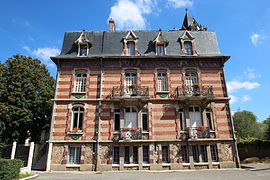 The town hall in Saulnières | |
show Location of Saulnières | |
 Saulnières | |
| Coordinates: 48°39′39″N 1°16′23″E / 48.6608°N 1.2731°ECoordinates: 48°39′39″N 1°16′23″E / 48.6608°N 1.2731°E | |
| Country | France |
| Region | Centre-Val de Loire |
| Department | Eure-et-Loir |
| Arrondissement | Dreux |
| Canton | Dreux-1 |
| Intercommunality | CA Pays de Dreux |
| Government | |
| • Mayor (2020–2026) | Christian Albert[1] |
| Area 1 | 10.65 km2 (4.11 sq mi) |
| Population (Jan. 2018)[2] | 717 |
| • Density | 67/km2 (170/sq mi) |
| Time zone | UTC+01:00 (CET) |
| • Summer (DST) | UTC+02:00 (CEST) |
| INSEE/Postal code | 28369 /28500 |
| Elevation | 116–169 m (381–554 ft) (avg. 170 m or 560 ft) |
| 1 French Land Register data, which excludes lakes, ponds, glaciers > 1 km2 (0.386 sq mi or 247 acres) and river estuaries. | |


Saulnières (French pronunciation: [so(l)njɛʁ]) is a commune in the Eure-et-Loir department in northern France. Le Tour has been known to pass through here.
Population[]
| Year | Pop. | ±% p.a. |
|---|---|---|
| 1968 | 357 | — |
| 1975 | 371 | +0.55% |
| 1982 | 475 | +3.59% |
| 1990 | 469 | −0.16% |
| 1999 | 538 | +1.54% |
| 2007 | 595 | +1.27% |
| 2012 | 643 | +1.56% |
| 2017 | 709 | +1.97% |
| Source: INSEE[3] | ||
See also[]
- Communes of the Eure-et-Loir department
References[]
- ^ "Répertoire national des élus: les maires". data.gouv.fr, Plateforme ouverte des données publiques françaises (in French). 2 December 2020. Retrieved 7 December 2020.
- ^ "Populations légales 2018". INSEE. 28 December 2020.
- ^ Population en historique depuis 1968, INSEE
| Wikimedia Commons has media related to Saulnières (Eure-et-Loir). |
| show Communes of the Eure-et-Loir department of France |
|---|
This Eure-et-Loir geographical article is a stub. You can help Wikipedia by . |
Categories:
- Communes of Eure-et-Loir
- Eure-et-Loir geography stubs