Mézières-en-Drouais
Mézières-en-Drouais | |
|---|---|
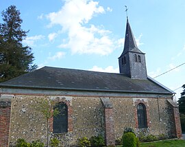 The temple in Mézières-en-Drouais | |
show Location of Mézières-en-Drouais | |
 Mézières-en-Drouais | |
| Coordinates: 48°43′31″N 1°25′31″E / 48.7253°N 1.4253°ECoordinates: 48°43′31″N 1°25′31″E / 48.7253°N 1.4253°E | |
| Country | France |
| Region | Centre-Val de Loire |
| Department | Eure-et-Loir |
| Arrondissement | Dreux |
| Canton | Dreux-2 |
| Intercommunality | CA Pays de Dreux |
| Government | |
| • Mayor (2014–2020) | Jean-Luc Hudebine |
| Area 1 | 8.4 km2 (3.2 sq mi) |
| Population (Jan. 2018)[1] | 1,067 |
| • Density | 130/km2 (330/sq mi) |
| Time zone | UTC+01:00 (CET) |
| • Summer (DST) | UTC+02:00 (CEST) |
| INSEE/Postal code | 28251 /28500 |
| Elevation | 81–134 m (266–440 ft) |
| 1 French Land Register data, which excludes lakes, ponds, glaciers > 1 km2 (0.386 sq mi or 247 acres) and river estuaries. | |


Mézières-en-Drouais is a commune in the Eure-et-Loir department and Centre-Val de Loire region of north-central France. It lies 32 km north of Chartres and some 70 km west of Paris.
Population[]
| Year | Pop. | ±% |
|---|---|---|
| 1946 | 768 | — |
| 1954 | 770 | +0.3% |
| 1962 | 654 | −15.1% |
| 1968 | 676 | +3.4% |
| 1975 | 681 | +0.7% |
| 1982 | 786 | +15.4% |
| 1990 | 1,018 | +29.5% |
| 1999 | 1,059 | +4.0% |
| 2007 | 1,062 | +0.3% |
| 2015 | 1,085 | +2.2% |
See also[]
- Communes of the Eure-et-Loir department
References[]
- ^ "Populations légales 2018". INSEE. 28 December 2020.
| Wikimedia Commons has media related to Mézières-en-Drouais. |
| show Communes of the Eure-et-Loir department of France |
|---|
| show Authority control |
|---|
This Eure-et-Loir geographical article is a stub. You can help Wikipedia by . |
Categories:
- Communes of Eure-et-Loir
- Eure-et-Loir geography stubs