Gas, Eure-et-Loir
Gas | |
|---|---|
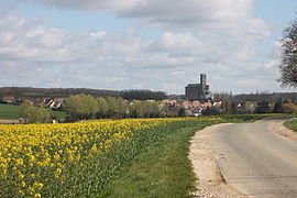 A general view of Gas | |
 Coat of arms | |
show Location of Gas | |
 Gas | |
| Coordinates: 48°33′58″N 1°40′05″E / 48.566°N 1.668°ECoordinates: 48°33′58″N 1°40′05″E / 48.566°N 1.668°E | |
| Country | France |
| Region | Centre-Val de Loire |
| Department | Eure-et-Loir |
| Arrondissement | Chartres |
| Canton | Épernon |
| Intercommunality | Portes Euréliennes d'Île-de-France |
| Government | |
| • Mayor (2008–2014) | François Dagron |
| Area 1 | 11.97 km2 (4.62 sq mi) |
| Population (Jan. 2018)[1] | 795 |
| • Density | 66/km2 (170/sq mi) |
| Time zone | UTC+01:00 (CET) |
| • Summer (DST) | UTC+02:00 (CEST) |
| INSEE/Postal code | 28172 /28320 |
| Elevation | 107–161 m (351–528 ft) (avg. 1,071 m or 3,514 ft) |
| 1 French Land Register data, which excludes lakes, ponds, glaciers > 1 km2 (0.386 sq mi or 247 acres) and river estuaries. | |


Gas is a commune in the Eure-et-Loir department in northern France.
Population[]
| Year | Pop. | ±% |
|---|---|---|
| 1962 | 243 | — |
| 1968 | 255 | +4.9% |
| 1975 | 305 | +19.6% |
| 1982 | 587 | +92.5% |
| 1990 | 623 | +6.1% |
| 1999 | 634 | +1.8% |
| 2008 | 763 | +20.3% |
See also[]
- Communes of the Eure-et-Loir department
References[]
- ^ "Populations légales 2018". INSEE. 28 December 2020.
| Wikimedia Commons has media related to Gas (Eure-et-Loir). |
| show Communes of the Eure-et-Loir department of France |
|---|
This Eure-et-Loir geographical article is a stub. You can help Wikipedia by . |
Categories:
- Communes of Eure-et-Loir
- Eure-et-Loir geography stubs