Briconville
Briconville | |
|---|---|
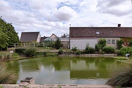 The pond in Briconville | |
 Coat of arms | |
show Location of Briconville | |
 Briconville | |
| Coordinates: 48°31′42″N 1°23′19″E / 48.5283°N 1.3886°ECoordinates: 48°31′42″N 1°23′19″E / 48.5283°N 1.3886°E | |
| Country | France |
| Region | Centre-Val de Loire |
| Department | Eure-et-Loir |
| Arrondissement | Chartres |
| Canton | Chartres-1 |
| Intercommunality | CA Chartres Métropole |
| Government | |
| • Mayor (2020–2026) | Jean-Louis Philippe[1] |
| Area 1 | 6.26 km2 (2.42 sq mi) |
| Population (Jan. 2018)[2] | 257 |
| • Density | 41/km2 (110/sq mi) |
| Time zone | UTC+01:00 (CET) |
| • Summer (DST) | UTC+02:00 (CEST) |
| INSEE/Postal code | 28060 /28300 |
| Elevation | 162–195 m (531–640 ft) (avg. 179 m or 587 ft) |
| 1 French Land Register data, which excludes lakes, ponds, glaciers > 1 km2 (0.386 sq mi or 247 acres) and river estuaries. | |


Briconville (French pronunciation: [bʁikɔ̃vil]) is a commune in the Eure-et-Loir department in northern France.
Population[]
| Year | Pop. | ±% |
|---|---|---|
| 1962 | 29 | — |
| 1968 | 44 | +51.7% |
| 1975 | 50 | +13.6% |
| 1982 | 78 | +56.0% |
| 1990 | 93 | +19.2% |
| 1999 | 113 | +21.5% |
| 2008 | 114 | +0.9% |
See also[]
- Communes of the Eure-et-Loir department
References[]
- ^ "Répertoire national des élus: les maires". data.gouv.fr, Plateforme ouverte des données publiques françaises (in French). 2 December 2020.
- ^ "Populations légales 2018". INSEE. 28 December 2020.
| Wikimedia Commons has media related to Briconville. |
| show Communes of the Eure-et-Loir department of France |
|---|
This Eure-et-Loir geographical article is a stub. You can help Wikipedia by . |
Categories:
- Communes of Eure-et-Loir
- Eure-et-Loir geography stubs