Gohory
Gohory | |
|---|---|
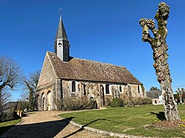 Saint-Michel church | |
show Location of Gohory | |
 Gohory | |
| Coordinates: 48°10′01″N 1°13′43″E / 48.1669°N 1.2287°ECoordinates: 48°10′01″N 1°13′43″E / 48.1669°N 1.2287°E | |
| Country | France |
| Region | Centre-Val de Loire |
| Department | Eure-et-Loir |
| Arrondissement | Châteaudun |
| Canton | Brou |
| Intercommunality | CC du Grand Châteaudun |
| Government | |
| • Mayor (2020–2026) | François Malzert[1] |
| Area 1 | 9.47 km2 (3.66 sq mi) |
| Population (Jan. 2018)[2] | 319 |
| • Density | 34/km2 (87/sq mi) |
| Time zone | UTC+01:00 (CET) |
| • Summer (DST) | UTC+02:00 (CEST) |
| INSEE/Postal code | 28182 /28160 |
| Elevation | 161–180 m (528–591 ft) (avg. 170 m or 560 ft) |
| 1 French Land Register data, which excludes lakes, ponds, glaciers > 1 km2 (0.386 sq mi or 247 acres) and river estuaries. | |


Gohory is a commune in the Eure-et-Loir department and Centre-Val de Loire region of north-central France. It lies 36 km south-west of Chartres and some 115 km from Paris.
Population[]
| Year | Pop. | ±% |
|---|---|---|
| 1946 | 333 | — |
| 1954 | 293 | −12.0% |
| 1962 | 300 | +2.4% |
| 1968 | 258 | −14.0% |
| 1975 | 226 | −12.4% |
| 1982 | 223 | −1.3% |
| 1990 | 234 | +4.9% |
| 1999 | 222 | −5.1% |
| 2008 | 273 | +23.0% |
| 2015 | 328 | +20.1% |
See also[]
- Communes of the Eure-et-Loir department
References[]
- ^ "Répertoire national des élus: les maires". data.gouv.fr, Plateforme ouverte des données publiques françaises (in French). 2 December 2020.
- ^ "Populations légales 2018". INSEE. 28 December 2020.
| Wikimedia Commons has media related to Gohory. |
| show Communes of the Eure-et-Loir department of France |
|---|
This Eure-et-Loir geographical article is a stub. You can help Wikipedia by . |
Categories:
- Communes of Eure-et-Loir
- Eure-et-Loir geography stubs