Varize, Eure-et-Loir
Varize | |
|---|---|
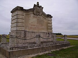 War memorial | |
show Location of Varize | |
 Varize | |
| Coordinates: 48°05′44″N 1°30′52″E / 48.0956°N 1.5144°ECoordinates: 48°05′44″N 1°30′52″E / 48.0956°N 1.5144°E | |
| Country | France |
| Region | Centre-Val de Loire |
| Department | Eure-et-Loir |
| Arrondissement | Châteaudun |
| Canton | Les Villages Vovéens |
| Government | |
| • Mayor (2020–2026) | Philippe Gaucheron[1] |
| Area 1 | 13.85 km2 (5.35 sq mi) |
| Population (Jan. 2018)[2] | 195 |
| • Density | 14/km2 (36/sq mi) |
| Time zone | UTC+01:00 (CET) |
| • Summer (DST) | UTC+02:00 (CEST) |
| INSEE/Postal code | 28400 /28140 |
| Elevation | 112–137 m (367–449 ft) (avg. 118 m or 387 ft) |
| 1 French Land Register data, which excludes lakes, ponds, glaciers > 1 km2 (0.386 sq mi or 247 acres) and river estuaries. | |


Varize is a commune in the Eure-et-Loir department in northern France.
Population[]
| Year | Pop. | ±% |
|---|---|---|
| 1962 | 160 | — |
| 1968 | 222 | +38.7% |
| 1975 | 189 | −14.9% |
| 1982 | 176 | −6.9% |
| 1990 | 180 | +2.3% |
| 1999 | 167 | −7.2% |
| 2008 | 210 | +25.7% |
See also[]
- Communes of the Eure-et-Loir department
References[]
- ^ "Répertoire national des élus: les maires". data.gouv.fr, Plateforme ouverte des données publiques françaises (in French). 2 December 2020. Retrieved 7 December 2020.
- ^ "Populations légales 2018". INSEE. 28 December 2020.
| Wikimedia Commons has media related to Varize (Eure-et-Loir). |
| show Communes of the Eure-et-Loir department of France |
|---|
This Eure-et-Loir geographical article is a stub. You can help Wikipedia by . |
Categories:
- Communes of Eure-et-Loir
- Eure-et-Loir geography stubs