Bavelincourt
Bavelincourt | |
|---|---|
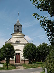 The church in Bavelincourt | |
show Location of Bavelincourt | |
 Bavelincourt | |
| Coordinates: 49°59′14″N 2°27′19″E / 49.9872°N 2.4553°ECoordinates: 49°59′14″N 2°27′19″E / 49.9872°N 2.4553°E | |
| Country | France |
| Region | Hauts-de-France |
| Department | Somme |
| Arrondissement | Amiens |
| Canton | Corbie |
| Intercommunality | CC Territoire Nord Picardie |
| Government | |
| • Mayor (2020–2026) | Alain Jumelle[1] |
| Area 1 | 7.75 km2 (2.99 sq mi) |
| Population (Jan. 2018)[2] | 99 |
| • Density | 13/km2 (33/sq mi) |
| Time zone | UTC+01:00 (CET) |
| • Summer (DST) | UTC+02:00 (CEST) |
| INSEE/Postal code | 80056 /80260 |
| Elevation | 42–128 m (138–420 ft) (avg. 49 m or 161 ft) |
| 1 French Land Register data, which excludes lakes, ponds, glaciers > 1 km2 (0.386 sq mi or 247 acres) and river estuaries. | |


Bavelincourt is a commune in the Somme department in Hauts-de-France in northern France.
Geography[]
Bavelincourt is situated on the D119 road, 24 kilometres (15 mi) northeast of Amiens.
Population[]
| Year | 1962 | 1968 | 1975 | 1982 | 1990 | 1999 | 2006 |
|---|---|---|---|---|---|---|---|
| Population | 63 | 87 | 81 | 67 | 74 | 85 | 109 |
| From the year 1962 on: No double counting—residents of multiple communes (e.g. students and military personnel) are counted only once. | |||||||
See also[]
References[]
- ^ "Répertoire national des élus: les maires". data.gouv.fr, Plateforme ouverte des données publiques françaises (in French). 2 December 2020. Retrieved 7 December 2020.
- ^ "Populations légales 2018". INSEE. 28 December 2020.
External links[]
| Wikimedia Commons has media related to Bavelincourt. |
(All French language)
Categories:
- Communes of Somme (department)
- Amiens arrondissement geography stubs