Bayencourt
Bayencourt | |
|---|---|
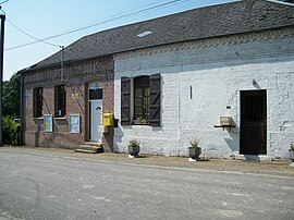 The town hall of Bayencourt | |
show Location of Bayencourt | |
 Bayencourt | |
| Coordinates: 50°07′57″N 2°34′26″E / 50.1325°N 2.574°ECoordinates: 50°07′57″N 2°34′26″E / 50.1325°N 2.574°E | |
| Country | France |
| Region | Hauts-de-France |
| Department | Somme |
| Arrondissement | Péronne |
| Canton | Albert |
| Intercommunality | Communauté de communes du Pays du Coquelicot |
| Government | |
| • Mayor (2020–2026) | Virginie Adamczyk[1] |
| Area 1 | 1.84 km2 (0.71 sq mi) |
| Population (Jan. 2018)[2] | 78 |
| • Density | 42/km2 (110/sq mi) |
| Time zone | UTC+01:00 (CET) |
| • Summer (DST) | UTC+02:00 (CEST) |
| INSEE/Postal code | 80057 /80560 |
| Elevation | 110–157 m (361–515 ft) (avg. 200 m or 660 ft) |
| 1 French Land Register data, which excludes lakes, ponds, glaciers > 1 km2 (0.386 sq mi or 247 acres) and river estuaries. | |


Bayencourt is a commune in the Somme department in Hauts-de-France in northern France.
Geography[]
A very small village, situated on the junction of the D23 and D129 roads, about halfway between Arras and Amiens.
Population[]
| Year | 1962 | 1968 | 1975 | 1982 | 1990 | 1999 | 2006 |
|---|---|---|---|---|---|---|---|
| Population | 67 | 76 | 70 | 72 | 64 | 73 | 70 |
| From the year 1962 on: No double counting—residents of multiple communes (e.g. students and military personnel) are counted only once. | |||||||
See also[]
References[]
- ^ "Répertoire national des élus: les maires". data.gouv.fr, Plateforme ouverte des données publiques françaises (in French). 2 December 2020. Retrieved 7 December 2020.
- ^ "Populations légales 2018". INSEE. 28 December 2020.
| Wikimedia Commons has media related to Bayencourt. |
Categories:
- Communes of Somme (department)
- Péronne arrondissement geography stubs