Beauquesne
From Wikipedia, the free encyclopedia
Commune in Hauts-de-France, France
Beauquesne | |
|---|---|
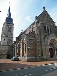 The church in Beauquesne | |
 Coat of arms | |
 Beauquesne  Beauquesne | |
Coordinates:  50°05′07″N 2°23′33″E / 50.0853°N 2.3925°E / 50.0853; 2.3925Coordinates: 50°05′07″N 2°23′33″E / 50.0853°N 2.3925°E / 50.0853; 2.3925 50°05′07″N 2°23′33″E / 50.0853°N 2.3925°E / 50.0853; 2.3925Coordinates: 50°05′07″N 2°23′33″E / 50.0853°N 2.3925°E / 50.0853; 2.3925 | |
| Country | France |
| Region | Hauts-de-France |
| Department | Somme |
| Arrondissement | Amiens |
| Canton | Doullens |
| Intercommunality | CC Territoire Nord Picardie |
| Government | |
| • Mayor (2020–2026) | François Durieux |
| Area 1 | 20.04 km2 (7.74 sq mi) |
| Population (Jan. 2018)[1] | 1,318 |
| • Density | 66/km2 (170/sq mi) |
| Time zone | UTC+01:00 (CET) |
| • Summer (DST) | UTC+02:00 (CEST) |
| INSEE/Postal code | 80070 /80600 |
| Elevation | 98–164 m (322–538 ft) (avg. 144 m or 472 ft) |
| 1 French Land Register data, which excludes lakes, ponds, glaciers > 1 km2 (0.386 sq mi or 247 acres) and river estuaries. | |

Beauquesne is a commune in the Somme department in Hauts-de-France in northern France. The name comes from the Picard for the oak tree, ‘quesne’
Contents
Geography[]
Situated at the junction of the D23 and the D31 roads, 17 miles to the north of Amiens
Population[]
| Year | 1962 | 1968 | 1975 | 1982 | 1990 | 1999 | 2006 |
|---|---|---|---|---|---|---|---|
| Population | 1242 | 1265 | 1194 | 1139 | 1147 | 1176 | 1342 |
| From the year 1962 on: No double counting—residents of multiple communes (e.g. students and military personnel) are counted only once. | |||||||
See also[]
References[]
- ^ "Populations légales 2018". INSEE. 28 December 2020.
| Wikimedia Commons has media related to Beauquesne. |
show
Communes of the Somme department | |
|---|---|
|
| show Authority control | |
|---|---|
| General |
|
| National libraries | |
This Arrondissement of Amiens geographical article is a stub. You can help Wikipedia by . |
- v
- t
Retrieved from ""
Categories:
- Communes of Somme (department)
- Amiens arrondissement geography stubs
Hidden categories:
- Articles with short description
- Short description is different from Wikidata
- Infobox mapframe without OSM relation ID on Wikidata
- Coordinates on Wikidata
- Pages using infobox settlement with image map1 but not image map
- Commons category link is on Wikidata
- Articles with VIAF identifiers
- Articles with BNF identifiers
- Articles with WorldCat-VIAF identifiers
- All stub articles
- Pages using the Kartographer extension