Berny-en-Santerre
Berny-en-Santerre | |
|---|---|
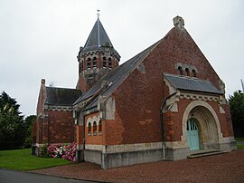 The church in Berny-en-Santerre | |
show Location of Berny-en-Santerre | |
 Berny-en-Santerre | |
| Coordinates: 49°51′56″N 2°51′02″E / 49.8656°N 2.8506°ECoordinates: 49°51′56″N 2°51′02″E / 49.8656°N 2.8506°E | |
| Country | France |
| Region | Hauts-de-France |
| Department | Somme |
| Arrondissement | Péronne |
| Canton | Ham |
| Intercommunality | CC Terre de Picardie |
| Government | |
| • Mayor (2020–2026) | Francis Leroy[1] |
| Area 1 | 4.43 km2 (1.71 sq mi) |
| Population (Jan. 2018)[2] | 153 |
| • Density | 35/km2 (89/sq mi) |
| Time zone | UTC+01:00 (CET) |
| • Summer (DST) | UTC+02:00 (CEST) |
| INSEE/Postal code | 80090 /80200 |
| Elevation | 62–87 m (203–285 ft) (avg. 140 m or 460 ft) |
| 1 French Land Register data, which excludes lakes, ponds, glaciers > 1 km2 (0.386 sq mi or 247 acres) and river estuaries. | |


Berny-en-Santerre is a commune in the Somme department in Hauts-de-France in northern France.
Geography[]
The commune is situated at the junction of the D146 and D150 roads, one mile from the junction of the A1 and A29 autoroutes, some 30 miles (48 km) east of Amiens.
Population[]
| Year | 1962 | 1968 | 1975 | 1982 | 1990 | 1999 | 2006 |
|---|---|---|---|---|---|---|---|
| Population | 172 | 174 | 169 | 146 | 149 | 153 | 144 |
| From the year 1962 on: No double counting—residents of multiple communes (e.g. students and military personnel) are counted only once. | |||||||
Personalities[]
- Galiot Mandat de Grancey
See also[]
References[]
- ^ "Répertoire national des élus: les maires". data.gouv.fr, Plateforme ouverte des données publiques françaises (in French). 2 December 2020.
- ^ "Populations légales 2018". INSEE. 28 December 2020.
| Wikimedia Commons has media related to Berny-en-Santerre. |
Categories:
- Communes of Somme (department)
- Péronne arrondissement geography stubs