Caix
Caix | |
|---|---|
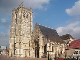 The church in Caix | |
show Location of Caix | |
 Caix | |
| Coordinates: 49°49′02″N 2°38′47″E / 49.8172°N 2.6464°ECoordinates: 49°49′02″N 2°38′47″E / 49.8172°N 2.6464°E | |
| Country | France |
| Region | Hauts-de-France |
| Department | Somme |
| Arrondissement | Péronne |
| Canton | Moreuil |
| Intercommunality | CC Terre de Picardie |
| Government | |
| • Mayor (2020–2026) | Sabine Scribe[1] |
| Area 1 | 11.95 km2 (4.61 sq mi) |
| Population (Jan. 2018)[2] | 719 |
| • Density | 60/km2 (160/sq mi) |
| Time zone | UTC+01:00 (CET) |
| • Summer (DST) | UTC+02:00 (CEST) |
| INSEE/Postal code | 80162 /80170 |
| Elevation | 53–97 m (174–318 ft) (avg. 90 m or 300 ft) |
| 1 French Land Register data, which excludes lakes, ponds, glaciers > 1 km2 (0.386 sq mi or 247 acres) and river estuaries. | |


Caix is a commune in the Somme department in Hauts-de-France in northern France.
Geography[]
Caix is situated on the D28 road, some 20 miles (32 km) southeast of Amiens.
First World War[]
In the First World War Caix was under German occupation for most of the period. It was recaptured by the 1st Canadian Division on 8 August 1918.[3]
Population[]
| Year | 1962 | 1968 | 1975 | 1982 | 1990 | 1999 | 2006 |
|---|---|---|---|---|---|---|---|
| Population | 719 | 722 | 650 | 611 | 621 | 658 | 709 |
| From the year 1962 on: No double counting—residents of multiple communes (e.g. students and military personnel) are counted only once. | |||||||
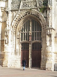
Church portal
See also[]
References[]
- ^ "Répertoire national des élus: les maires". data.gouv.fr, Plateforme ouverte des données publiques françaises (in French). 2 December 2020.
- ^ "Populations légales 2018". INSEE. 28 December 2020.
- ^ The First World War Remembered, Gary Sheffield
External links[]
| Wikimedia Commons has media related to Caix. |
- Caix on the Quid website (in French)
Categories:
- Communes of Somme (department)
- Péronne arrondissement geography stubs