Coisy
Coisy | |
|---|---|
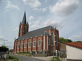 The church in Coisy | |
show Location of Coisy | |
 Coisy | |
| Coordinates: 49°57′38″N 2°19′42″E / 49.9606°N 2.3283°ECoordinates: 49°57′38″N 2°19′42″E / 49.9606°N 2.3283°E | |
| Country | France |
| Region | Hauts-de-France |
| Department | Somme |
| Arrondissement | Amiens |
| Canton | Amiens-2 |
| Intercommunality | CC Territoire Nord Picardie |
| Government | |
| • Mayor (2020–2026) | Claude Deflesselle[1] |
| Area 1 | 6.08 km2 (2.35 sq mi) |
| Population (Jan. 2018)[2] | 348 |
| • Density | 57/km2 (150/sq mi) |
| Time zone | UTC+01:00 (CET) |
| • Summer (DST) | UTC+02:00 (CEST) |
| INSEE/Postal code | 80202 /80260 |
| Elevation | 71–129 m (233–423 ft) (avg. 110 m or 360 ft) |
| 1 French Land Register data, which excludes lakes, ponds, glaciers > 1 km2 (0.386 sq mi or 247 acres) and river estuaries. | |


Coisy is a commune in the Somme department in Hauts-de-France in northern France.
Geography[]
Coisy is situated on the D11a between the D11 and the N25, some 5 miles (8 km) north of Amiens.
History[]
Coisy is first mentioned in the 12th century, when it was under the jurisdiction of the seigneurs of Beauquesne.
A Benedictine priory was established at the hamlet of Flesserolles in 1156, under Anchin Abbey.
By the end of the 14th century, Coisy was governed by the Bureau de la Rivière.
Protestant assemblies were set up in 1570.
Marshall Biron and his troops stopped here in 1597, during the French Wars of Religion.
Population[]
| Year | 1962 | 1968 | 1975 | 1982 | 1990 | 1999 | 2006 |
|---|---|---|---|---|---|---|---|
| Population | 183 | 196 | 175 | 184 | 226 | 246 | 283 |
| From the year 1962 on: No double counting—residents of multiple communes (e.g. students and military personnel) are counted only once. | |||||||
See also[]
References[]
- ^ "Répertoire national des élus: les maires". data.gouv.fr, Plateforme ouverte des données publiques françaises (in French). 2 December 2020.
- ^ "Populations légales 2018". INSEE. 28 December 2020.
External links[]
| Wikimedia Commons has media related to Coisy. |
Categories:
- Communes of Somme (department)
- Amiens arrondissement geography stubs