Cressy-Omencourt
Cressy-Omencourt | |
|---|---|
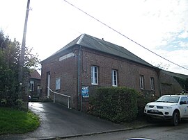 The town hall and school in Cressy-Omencourt | |
show Location of Cressy-Omencourt | |
 Cressy-Omencourt | |
| Coordinates: 49°43′40″N 2°55′00″E / 49.7278°N 2.9167°ECoordinates: 49°43′40″N 2°55′00″E / 49.7278°N 2.9167°E | |
| Country | France |
| Region | Hauts-de-France |
| Department | Somme |
| Arrondissement | Montdidier |
| Canton | Roye |
| Intercommunality | CC Grand Roye |
| Government | |
| • Mayor (2020–2026) | Olivier Depourcq[1] |
| Area 1 | 7.67 km2 (2.96 sq mi) |
| Population (Jan. 2018)[2] | 123 |
| • Density | 16/km2 (42/sq mi) |
| Time zone | UTC+01:00 (CET) |
| • Summer (DST) | UTC+02:00 (CEST) |
| INSEE/Postal code | 80224 /80190 |
| Elevation | 67–91 m (220–299 ft) (avg. 69 m or 226 ft) |
| 1 French Land Register data, which excludes lakes, ponds, glaciers > 1 km2 (0.386 sq mi or 247 acres) and river estuaries. | |


Cressy-Omencourt is a commune in the Somme department in Hauts-de-France in northern France.
Geography[]
Cressy-Omencourt is situated on the D227 and D15 crossroads, some 20 miles (32 km) southwest of Saint-Quentin.
Population[]
| Year | 1962 | 1968 | 1975 | 1982 | 1990 | 1999 | 2006 |
|---|---|---|---|---|---|---|---|
| Population | 73 | 101 | 89 | 89 | 116 | 106 | 104 |
| From the year 1962 on: No double counting—residents of multiple communes (e.g. students and military personnel) are counted only once. | |||||||
See also[]
References[]
- ^ "Répertoire national des élus: les maires". data.gouv.fr, Plateforme ouverte des données publiques françaises (in French). 2 December 2020.
- ^ "Populations légales 2018". INSEE. 28 December 2020.
| Wikimedia Commons has media related to Cressy-Omencourt. |
Categories:
- Communes of Somme (department)
- Montdidier arrondissement geography stubs