Doingt
Doingt | |
|---|---|
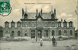 The railway station of Péronne-Flamicourt, in 1909 | |
 Coat of arms | |
show Location of Doingt | |
 Doingt | |
| Coordinates: 49°55′25″N 2°57′58″E / 49.9236°N 2.9661°ECoordinates: 49°55′25″N 2°57′58″E / 49.9236°N 2.9661°E | |
| Country | France |
| Region | Hauts-de-France |
| Department | Somme |
| Arrondissement | Péronne |
| Canton | Péronne |
| Intercommunality | Haute Somme |
| Government | |
| • Mayor (2020–2026) | Romuald Helfried[1] |
| Area 1 | 8.61 km2 (3.32 sq mi) |
| Population (Jan. 2018)[2] | 1,415 |
| • Density | 160/km2 (430/sq mi) |
| Time zone | UTC+01:00 (CET) |
| • Summer (DST) | UTC+02:00 (CEST) |
| INSEE/Postal code | 80240 /80200 |
| Elevation | 47–113 m (154–371 ft) (avg. 150 m or 490 ft) |
| 1 French Land Register data, which excludes lakes, ponds, glaciers > 1 km2 (0.386 sq mi or 247 acres) and river estuaries. | |


Doingt is a commune in the Somme department in Hauts-de-France in northern France.
Geography[]
Doingt is situated on the D937 and D199 junction, on the banks of the river Somme, some 30 miles (48 km) east of Amiens.
History[]
Completely destroyed during World War I. A Commonwealth cemetery is just outside the town.
Population[]
| Year | 1962 | 1968 | 1975 | 1982 | 1990 | 1999 | 2006 |
|---|---|---|---|---|---|---|---|
| Population | 1517 | 1542 | 1564 | 1449 | 1415 | 1383 | 1416 |
| From the year 1962 on: No double counting—residents of multiple communes (e.g. students and military personnel) are counted only once. | |||||||
See also[]
References[]
- ^ "Répertoire national des élus: les maires". data.gouv.fr, Plateforme ouverte des données publiques françaises (in French). 2 December 2020.
- ^ "Populations légales 2018". INSEE. 28 December 2020.
External links[]
| Wikimedia Commons has media related to Doingt. |
- CWG Cemetery
- Doingt on the Quid website (in French)
Categories:
- Communes of Somme (department)
- Péronne arrondissement geography stubs