Dompierre-Becquincourt
Dompierre-Becquincourt | |
|---|---|
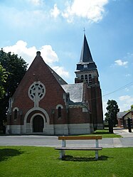 The church in Dompierre-Becquincourt | |
show Location of Dompierre-Becquincourt | |
 Dompierre-Becquincourt | |
| Coordinates: 49°54′29″N 2°48′21″E / 49.9081°N 2.8058°ECoordinates: 49°54′29″N 2°48′21″E / 49.9081°N 2.8058°E | |
| Country | France |
| Region | Hauts-de-France |
| Department | Somme |
| Arrondissement | Péronne |
| Canton | Ham |
| Intercommunality | CC Terre de Picardie |
| Government | |
| • Mayor (2020–2026) | Jean-Luc Maillard[1] |
| Area 1 | 11.05 km2 (4.27 sq mi) |
| Population (Jan. 2018)[2] | 708 |
| • Density | 64/km2 (170/sq mi) |
| Time zone | UTC+01:00 (CET) |
| • Summer (DST) | UTC+02:00 (CEST) |
| INSEE/Postal code | 80247 /80980 |
| Elevation | 54–92 m (177–302 ft) (avg. 100 m or 330 ft) |
| 1 French Land Register data, which excludes lakes, ponds, glaciers > 1 km2 (0.386 sq mi or 247 acres) and river estuaries. | |


Dompierre-Becquincourt is a commune in the Somme department in Hauts-de-France in northern France.
Geography[]
The commune is situated on the D71 road, some 30 miles (48 km) east of Amiens.
Population[]
| Year | 1962 | 1968 | 1975 | 1982 | 1990 | 1999 | 2006 |
|---|---|---|---|---|---|---|---|
| Population | 693 | 703 | 635 | 646 | 664 | 642 | 654 |
| From the year 1962 on: No double counting—residents of multiple communes (e.g. students and military personnel) are counted only once. | |||||||
Gallery[]

French World War I cemetery

French World War I cemetery


See also[]
References[]
- ^ "Répertoire national des élus: les maires". data.gouv.fr, Plateforme ouverte des données publiques françaises (in French). 2 December 2020.
- ^ "Populations légales 2018". INSEE. 28 December 2020.
| Wikimedia Commons has media related to Dompierre-Becquincourt. |
| show Authority control |
|---|
Categories:
- Communes of Somme (department)
- Péronne arrondissement geography stubs