Ferdrupt
Ferdrupt | |
|---|---|
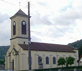 Church of Saint-Vincent-de-Paul | |
show Location of Ferdrupt | |
 Ferdrupt | |
| Coordinates: 47°54′30″N 6°42′36″E / 47.9083°N 6.71°ECoordinates: 47°54′30″N 6°42′36″E / 47.9083°N 6.71°E | |
| Country | France |
| Region | Grand Est |
| Department | Vosges |
| Arrondissement | Épinal |
| Canton | Le Thillot |
| Intercommunality | CC Ballons des Hautes-Vosges |
| Government | |
| • Mayor (2020–2026) | Étienne Colin |
| Area 1 | 14.6 km2 (5.6 sq mi) |
| Population (Jan. 2018)[1] | 722 |
| • Density | 49/km2 (130/sq mi) |
| Time zone | UTC+01:00 (CET) |
| • Summer (DST) | UTC+02:00 (CEST) |
| INSEE/Postal code | 88170 /88360 |
| Elevation | 444–903 m (1,457–2,963 ft) |
| 1 French Land Register data, which excludes lakes, ponds, glaciers > 1 km2 (0.386 sq mi or 247 acres) and river estuaries. | |


Ferdrupt (French pronunciation: [fɛʁdʁy] (![]() listen)) is a commune in the Vosges department in Grand Est in northeastern France.
listen)) is a commune in the Vosges department in Grand Est in northeastern France.
See also[]
References[]
- ^ "Populations légales 2018". INSEE. 28 December 2020.
| Wikimedia Commons has media related to Ferdrupt. |
| show Authority control |
|---|
This Vosges geographical article is a stub. You can help Wikipedia by . |
Categories:
- Communes of Vosges (department)
- Vosges (department) geography stubs